Waden Hill, Wilts.
(Close to Silbury Hill & Avebury stone circle).
Introduction: This crop circle was first reported on the 29th April 2026 in a field of Oilseed rape (canola). It measures (very) approximately 100ft in length.
Location details: Google Maps Link OS Grid Ref: SU 10495 68980. What-three-words: lease.tabs.amuses
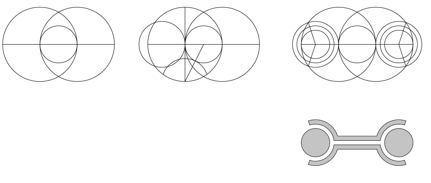
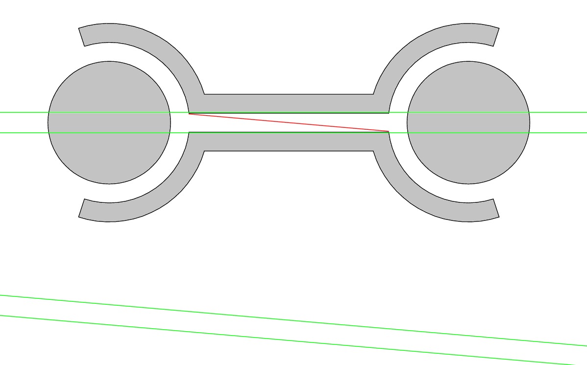
Description: The design of this crop circle harkens back to the ‘dumbbell’ formations of the very early 1990s. These designs were usually a variation upon the theme of two circles (or points) connected by a line. As such, they show us a crucial stage of the infolding of number in space – the division of unity. Researcher Peter van den Burg, has shown that the Waden Hill design is underpinned by the Vesica Pisces – another expression of the division of unity. See the Geometry Gallery below for his analysis.
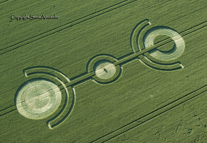
Langdean Bottom 2017
Connections: Interestingly, this crop circle sits directly upon a tractor-line. This is unusual, but not unique. This circle at Langdean Bottom, Wiltshire in 2017 (left) is very similar in design and also sits on the tractor-line – they could almost be seen as siblings.
Flight: We won’t be flying this circle, it’s just too small to cover with an aircraft. However you can see drone shots by Ben Sasson & Simon Young in the picture gallery below. We’d like to thank them for sharing their images with us.
Visiting: Please do not enter the field without seeking permission from the farmer. Please read our Visiting the Crop Circles section for a downloadable PDF about visiting the crop circles.
Inside the crop circle: Also featured in our gallery below are a few interior shots of this circle taken by researcher Tomasz Kaczmarek. Thanks to Tomasz for sharing his work with us.
Location History: Waden Hill lies between Silbury Hill and Avebury stone circle, in the heart of Wiltshire’s ancient sacred landscape. There have been crop circles at Waden Hill many times over the last 30 years. In our Image Library you can find the first circle we reported there from 1994. You can use the links in the text above to read more about both Silbury and Avebury.
Visiting the Circles? If you are thinking of visiting any crop circles this summer, please read our Visiting the Crop Circles section. It’s full of useful information and etiquette for visiting the countryside and the crop circles. Please remember that you should not enter any field without the express permission of the farmer.
Click here for Copyright Information about the reproduction of images on this website.
Please Help to keep us Flying in 2026: We hope to take to the skies again in 2026 to record the circles that appear this summer. If you have enjoyed looking at our pictures and information please consider making a small donation to keep us flying. There are so few of us left regularly recording the circles it’s really important that we continue. And while some now use drones to record the circles, it is important that there are still images taken from aircraft where the best quality camera equipment can be used and images that include the broad vista of the landscape can be taken. This kind of photography is expensive and it gets harder with each passing year to raise the funds we need to continue our work, but if everyone who regularly looked at this website made a small donation we would meet the funds we need. You can make a donation here.
NOTE: Some of the images below are beautiful landscape scenes. Click on each image to enlarge them and see the whole picture.
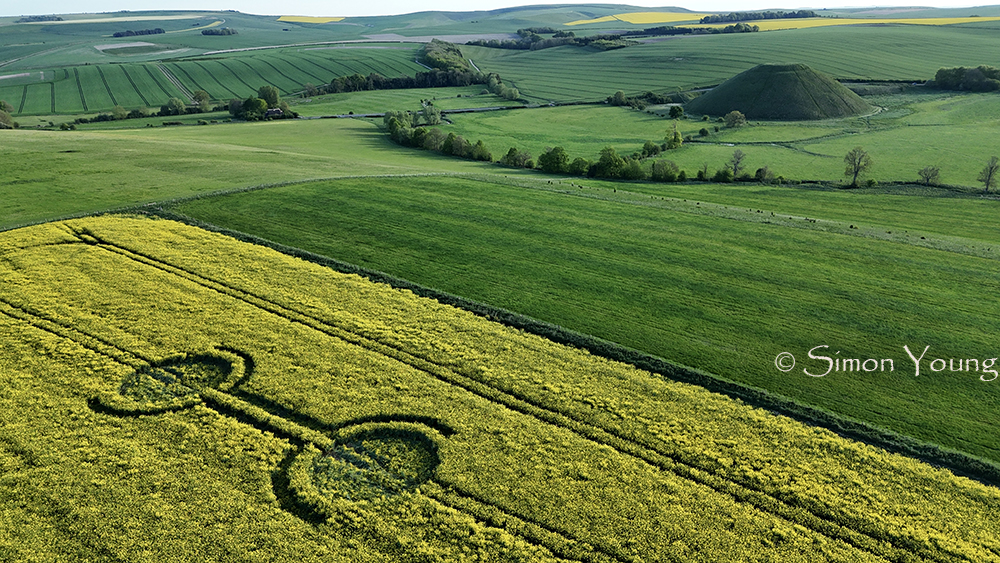
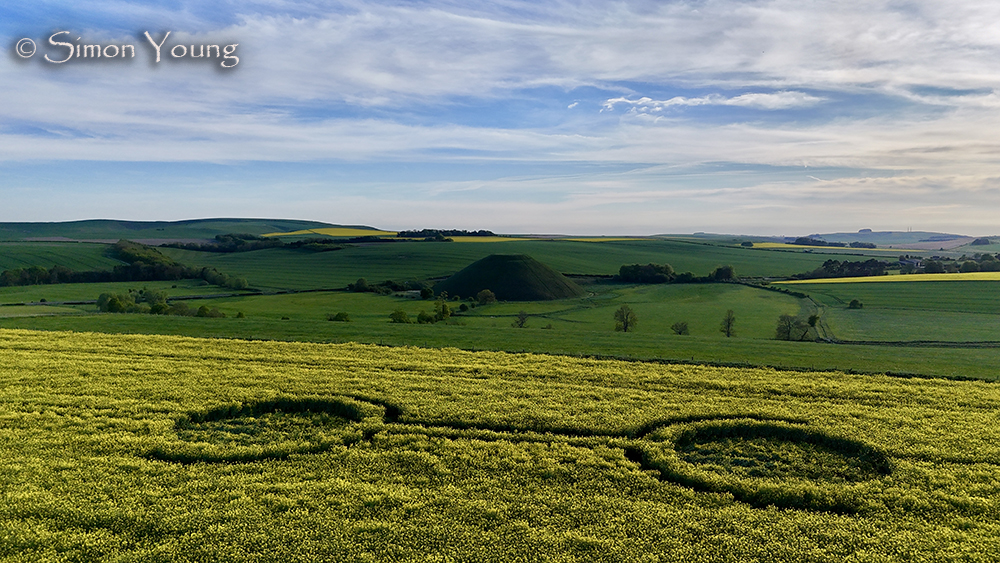
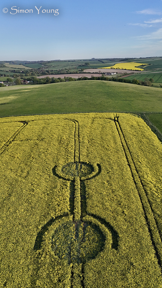
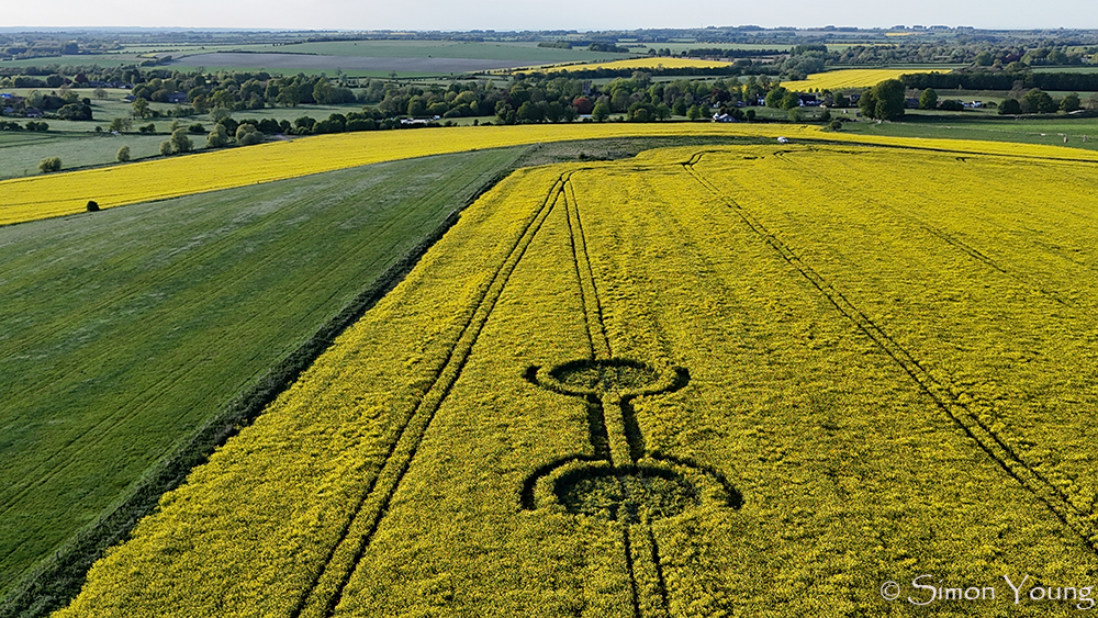
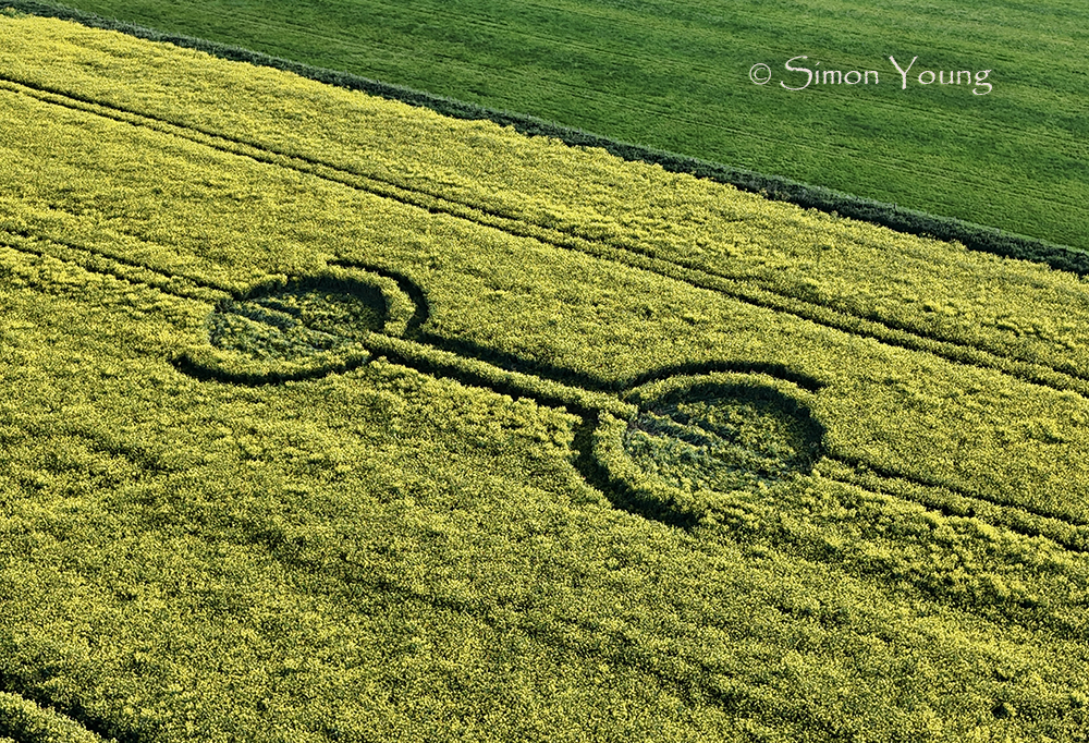
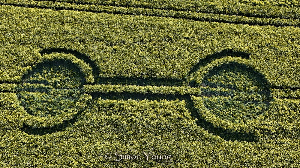
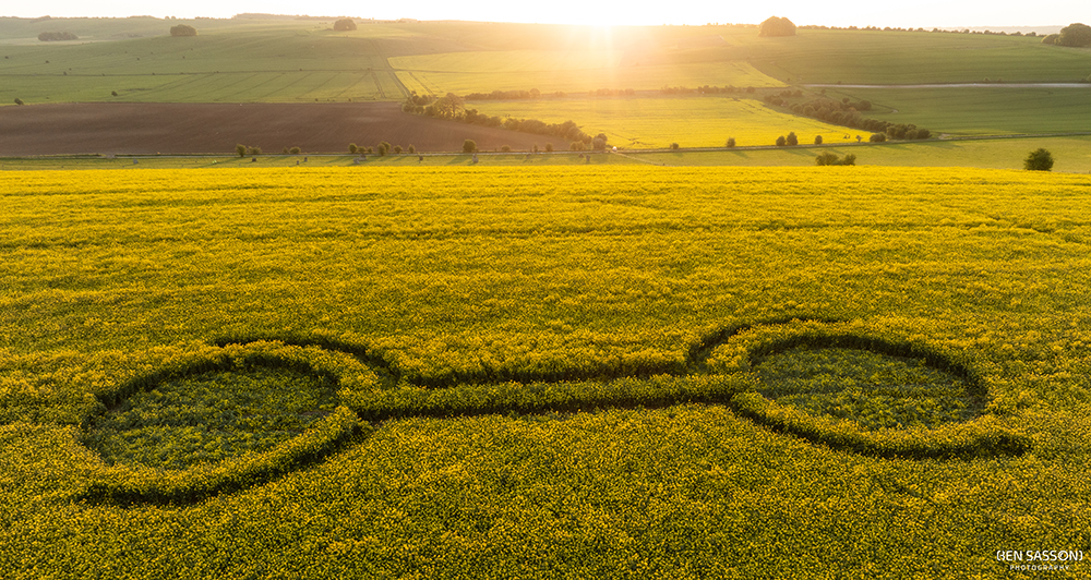
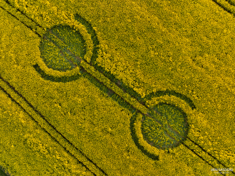
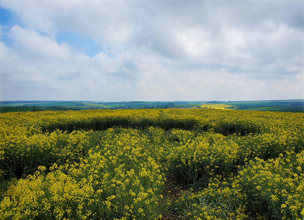
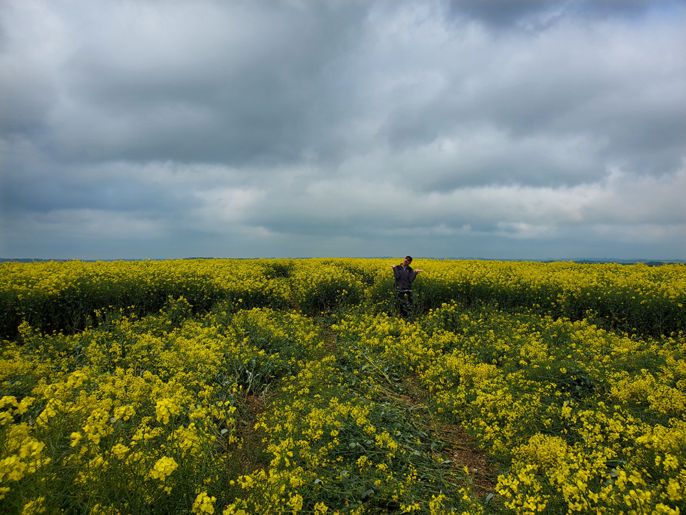
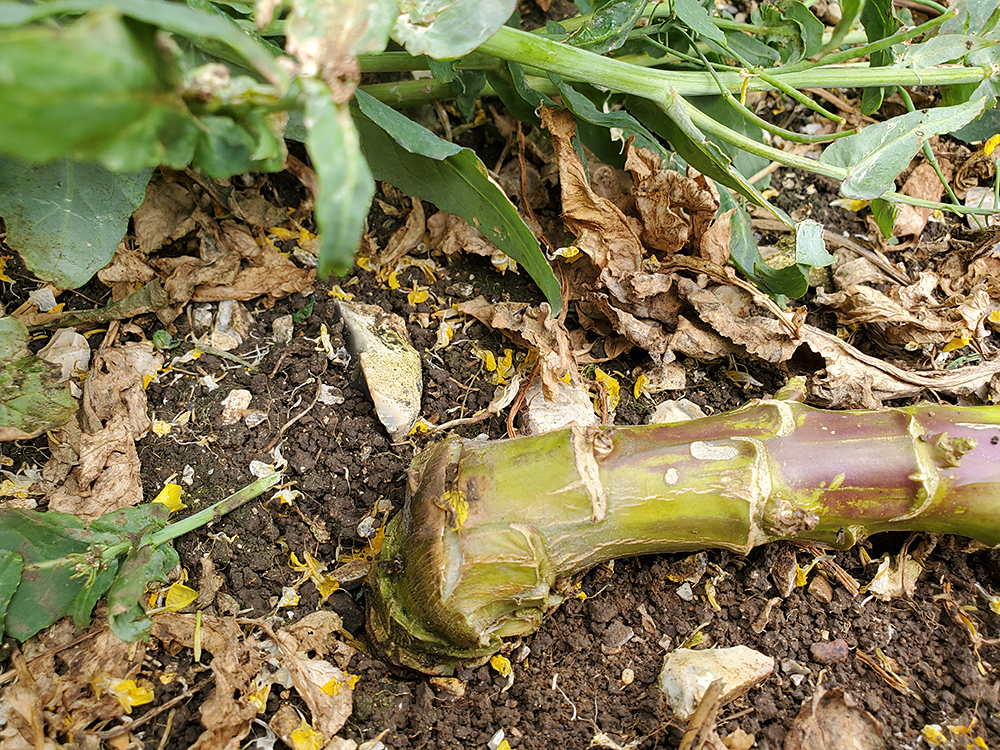
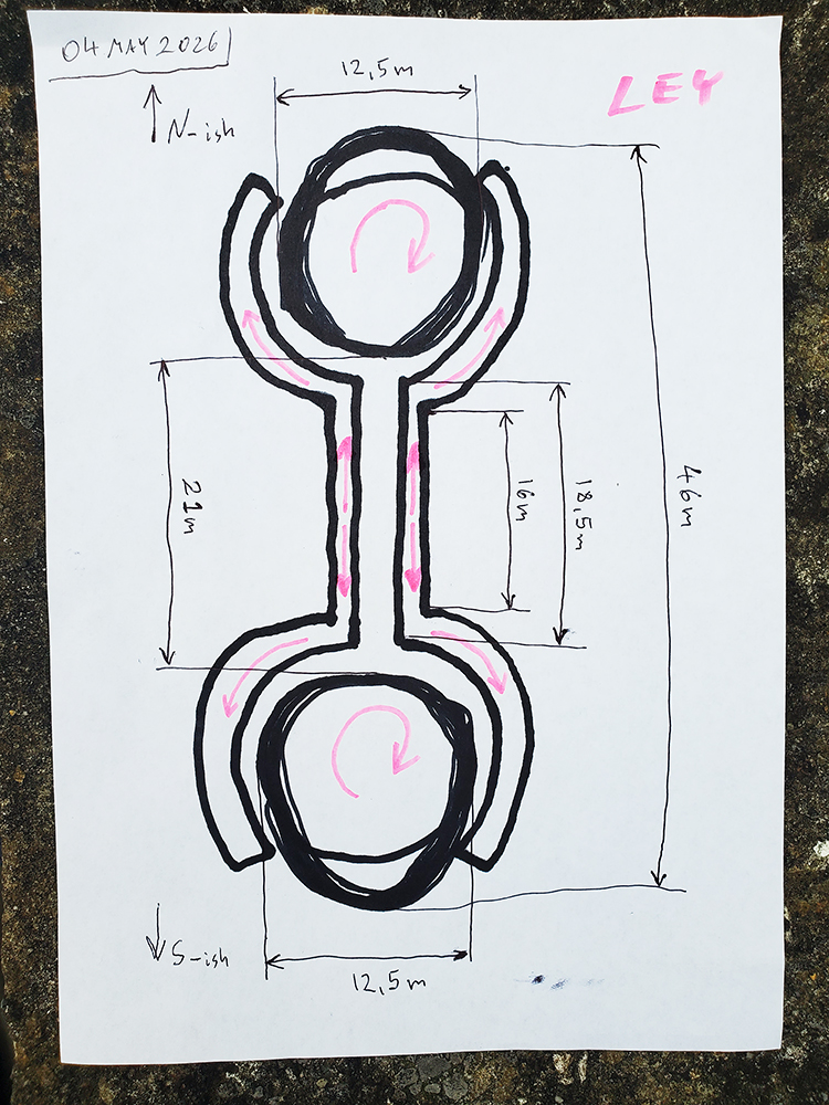
Image Licencing
We can supply high resolution images of many of our photographs and the sky is the limit as to what they can be used for! Choose from our extensive library or contact us to commission aerial photography for your project.
Geometry Gallery
You can read read more of Peter's excellent work on his Facebook Page Geometry of the Crop Circles.
Date
29.04.2026
Crop
Oilseed Rape (Canola)
Visiting
Google Maps Link. O.S. Grid Ref: SU 10495 68980. What-three-words: lease.tabs.amuses
You will need permission to visit this field from the farmer.
Further Reading
Find out more on the websites below: