Stoke Charity, Hants
(between Sutton Scotney & Micheldever)
Detail & Location: This circle was first reported on the 28th July 2024 in a field of wheat near Stoke Charity, in Hampshire – between Sutton Scotney and Micheldever. It measures approximately 220ft in diameter.
Google Maps Link. OS Grid Ref: SU 49055 38514. What-three-words: uplifing.deprive.path
Visiting: It is unknown if the farmer is allowing access. You will need to gain permission before entering this circle.
Location & History: There is a history of crop circles in this area, especially in recent years. Just to the north of the crop circle, on the other side of the river Dever lies Norsebury Ring, a late Bronze age hillfort. It is a univallate hillfort, meaning with one raised ring around a central enclosure. You can read more about this site here.
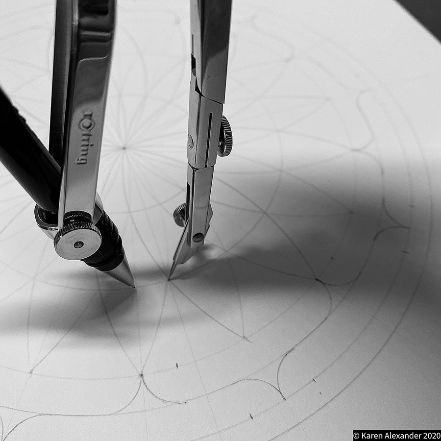
About this crop circle: This crop circle is a six-fold, hexagonal design. The design is picked from an isometric grid of equilateral triangles to create the highly original design. I look forward to drawing and exploring this circle further.
Please see the Geometry Gallery below for more details as we have them.
Visiting the Circles? If you are thinking of visiting any crop circles this summer, please read our Visiting the Crop Circles section. It’s full of useful information and etiquette for visiting the countryside and the crop circles. Please remember that you should not enter any fields without the express permission of the farmer.
Click here for Copyright Information about the reproduction of images on this website.
Please Help to keep us Flying in 2024: We hope to take to the skies again in 2024 to record the circles that appear this summer. If you have enjoyed looking at our pictures and information please consider making a small donation to keep us flying. There are so few of us left regularly recording the circles it’s really important that we continue. And while some now use drones to record the circles, it is important that there are still images taken from aircraft where the best quality camera equipment can be used and images that include the broad vista of the landscape can be taken. This kind of photography is expensive and it gets harder with each passing year to raise the funds we need to continue our work, but if everyone who regularly looked at this website made a small donation we would meet the funds we need. You can make a donation here.
NOTE: Some of the images below are beautiful landscape scenes. Click on each image to enlarge them and see the whole picture.
THANKS: Our grateful thanks to Ben Sasson for allowing us to feature his photographs on this page.
https://photography.bensasson.com/work
Instagram – @bensassonphotography
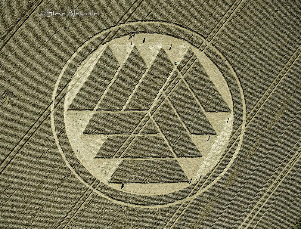
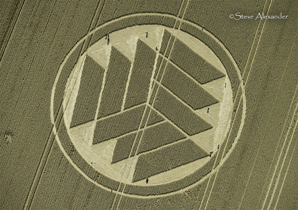
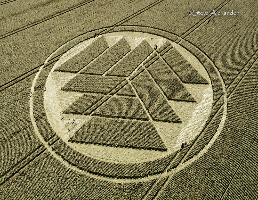
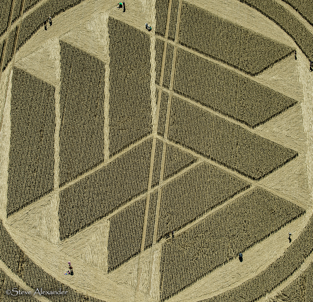
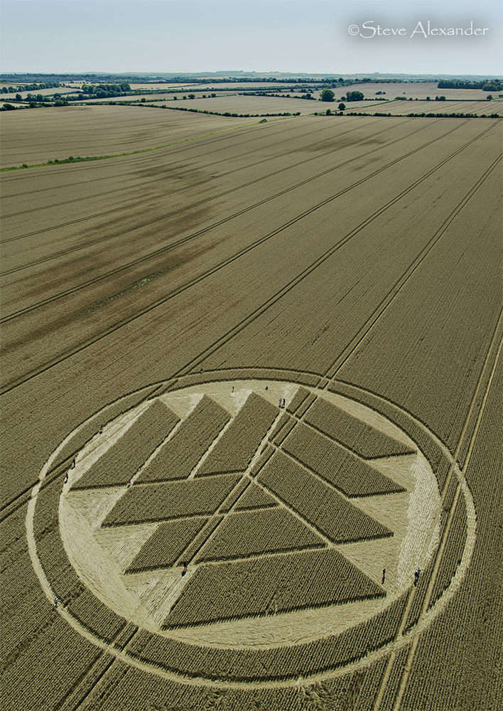
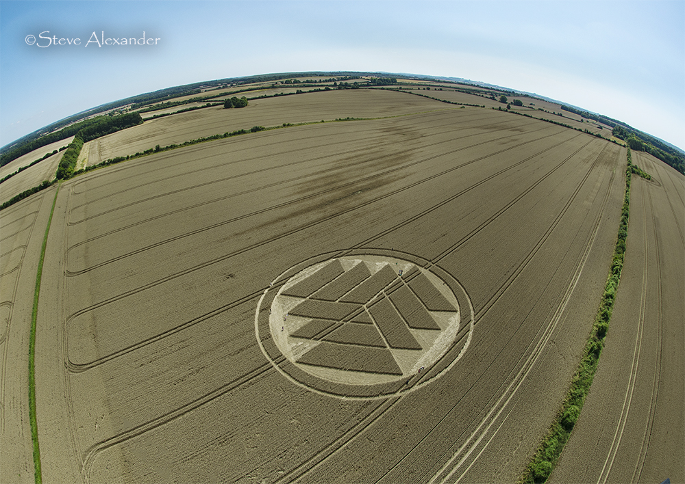
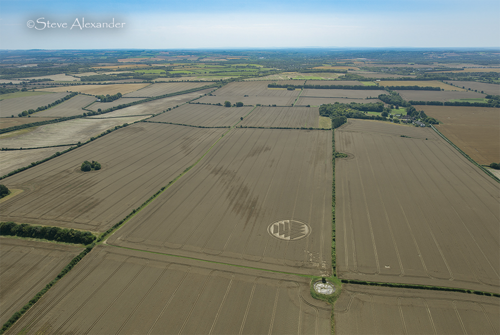
Image Licencing
We can supply high resolution images of many of our photographs and the sky is the limit as to what they can be used for! Choose from our extensive library or contact us to commission aerial photography for your project.
Geometry Gallery
It's on the drawing board! Check back for updates.
Date
28.07.2024
Crop
Wheat
Visiting
Google Maps Link. OS Grid Ref: SU 49055 38514. What-three-words: uplifing.deprive.path. It is unknown if the farmer is allowing access. You will need to gain permission before entering this circle.
Further Reading
Find out more on the websites below: