
Patney, Wiltshire.
(Close to Patney bridge, near to Etchilhampton)
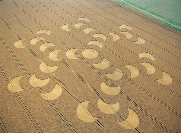
Detail & Location: This circle was reported on the 8th of August. It is in a field of wheat and measures approximately 600ft in diameter at its widest point. See the Google Maps link for precise location. It is the largest formation of the 2020 season so far.
Crop Circle Reporting and Covid-19: After considerable thought and consultation, we have decided we will not be censoring crop circle locations during the Covid-19 pandemic. There are no current restrictions in place in the UK that call for a blanket ban on visiting the countryside. We consider the reporting of crop circles to be in the spirit of journalism, and censorship to be an anathema to that spirit. Therefore, we will be treating the crop circle community as adults and asking everyone to approach the information carefully and responsibly. This will include not visiting the circles if the farmer has not given explicit permission to do so and should permission be given that they practice social distancing by staying 2 metres away from fellow visitors. It would be our very strong advice that visiting the crop circles on the ground should be kept to an absolute minimum for now. However, because we know that the location of any given circle can be important to researchers and those that record the circles from the air, we will continue to share what we know.
Flying during the Covid-19 Pandemic: Thanks to the hard work of all at Heliair, Thruxton, as of July 20th we have been able to return to the air to record the 2020 circles. We will still be working along-side the excellent AEROBO (Art in Flight) who will be helping us collect images and drone footage of the latest crop circles to share on the website.
Visiting: This crop circle has been harvested.
Flight: This flight took place during an unprecedented period of high pressure and temperatures in the UK – with the temperature reaching over 30 degrees centigrade for many consecutive days. As always, when then is a sustained period of high pressure, it traps in the dirty polluted air in the atmosphere causing heat inversions and general bad visibility in the atmosphere. When we took to the air for this flight, you could see the haze of that polluted air all around.

North Down Wiltshire, 2003. Also occurred during a time of high temperatures and air pollution.
This isn’t all that remarkable in of itself, but in what you might call an uncanny coincidence, the weather had also been like this when we had flown another so-called ‘Molecule’ crop circle back in 2003 – scroll down for a picture.
We were also fortunate that a train happened to be speeding alongside the field as we flew over, making for some interesting photographs!
History & Connections: Patney lies close to Etchilhampton, Marden and Chirton, all sites of crop circles over the years. The field was next door to the railway line and we saw several trains pass-by the formation – we wondered if you could see the circle from the train?
Design & Symbolism: This crop circle was quickly nick-named The Molecule – for obvious reasons. But there seem to be conflicting ideas as to what molecule it actually might be. This formation was huge, approximately as much as 600ft at its widest point! The central circle contained some lovely laid crop in both swirled and radial patterns. You can get a good view of this in some of the low shots in the gallery.
Stop back at this page for updates and a write-up very soon…
Visiting the Circles? If you are thinking of visiting any crop circles this summer, please read our Visiting the Crop Circles section. It’s full of useful information and etiquette for visiting the countryside and the crop circles. Please remember that you should not enter any fields without the express permission of the farmer and you will need to be aware of and abide by any restrictions in place in the UK in response to the Covid-19 pandemic.
Click here for Copyright Information about the reproduction of images on this website.
Please Help to keep us Flying in 2020 and beyond: If you have enjoyed looking at our pictures and information please consider making a small donation to keep us flying. There are so few of us left regularly recording the circles it’s really important that we continue. And while some now use drones to record the circles, it is important that there are still images taken from aircraft where the best quality camera equipment can be used and images that include the broad vista of the landscape can be taken. This kind of photography is expensive and it gets harder with each passing year to raise the funds we need to continue our work, but if everyone who regularly looked at this website made a small donation we would meet the funds we need. You can make a donation here.
NOTE: Some of the images below are beautiful landscape scenes. Click on each image to enlarge them and see the whole picture.
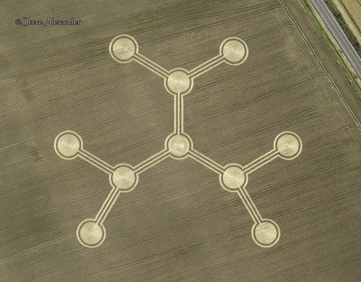
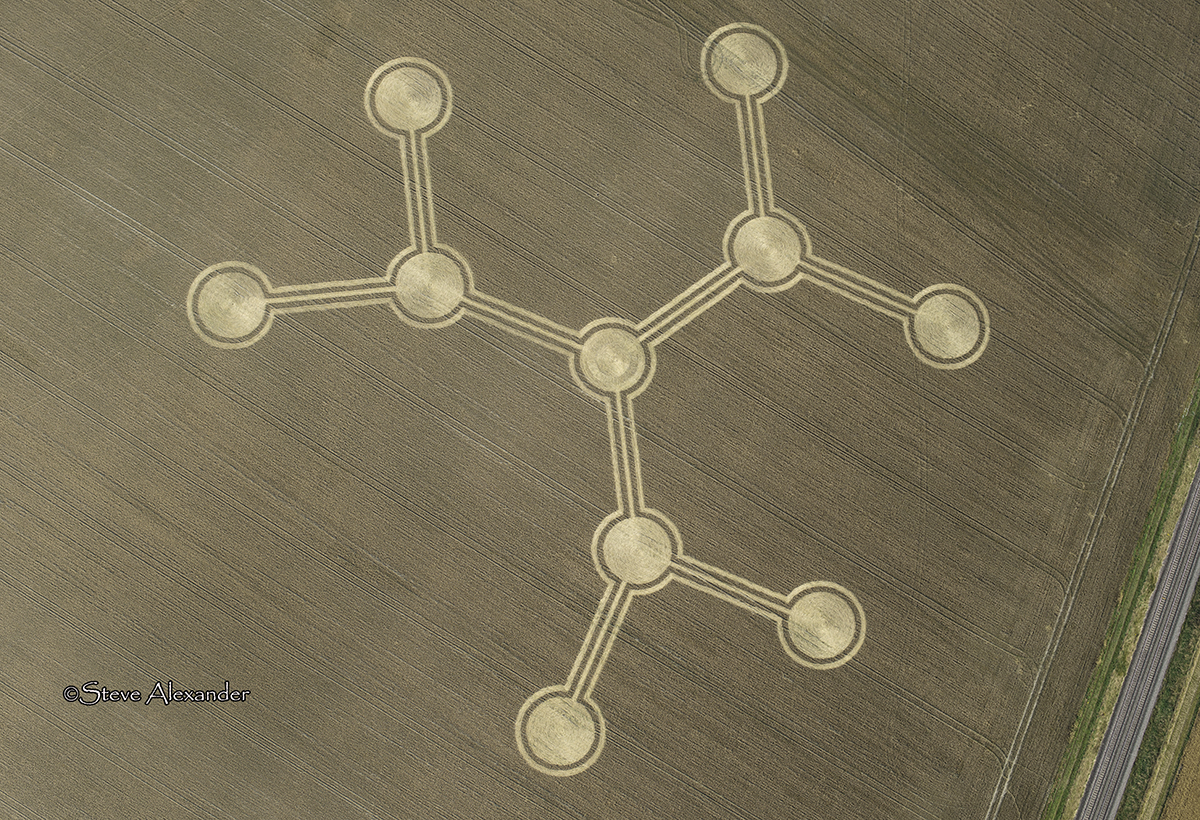
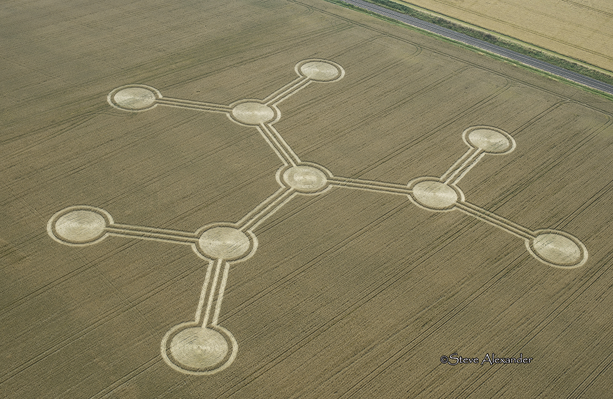
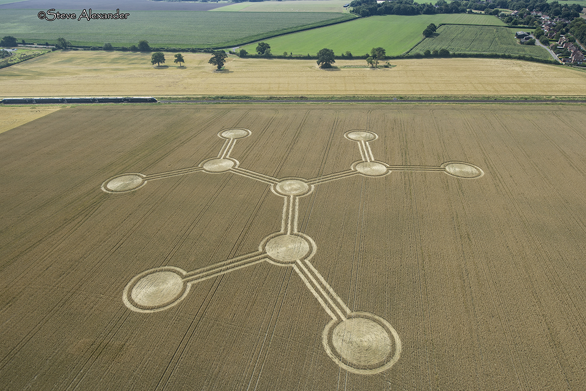
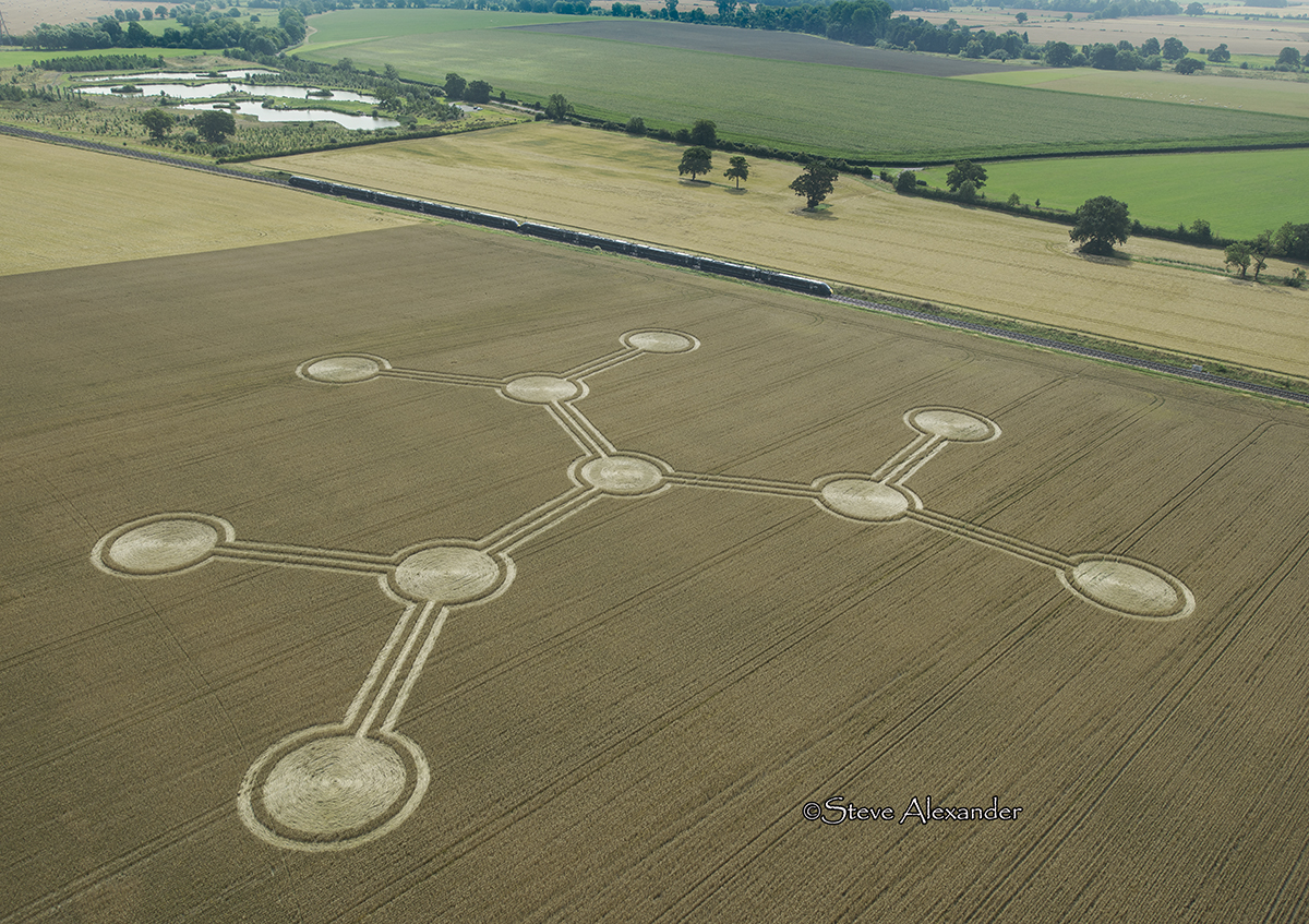
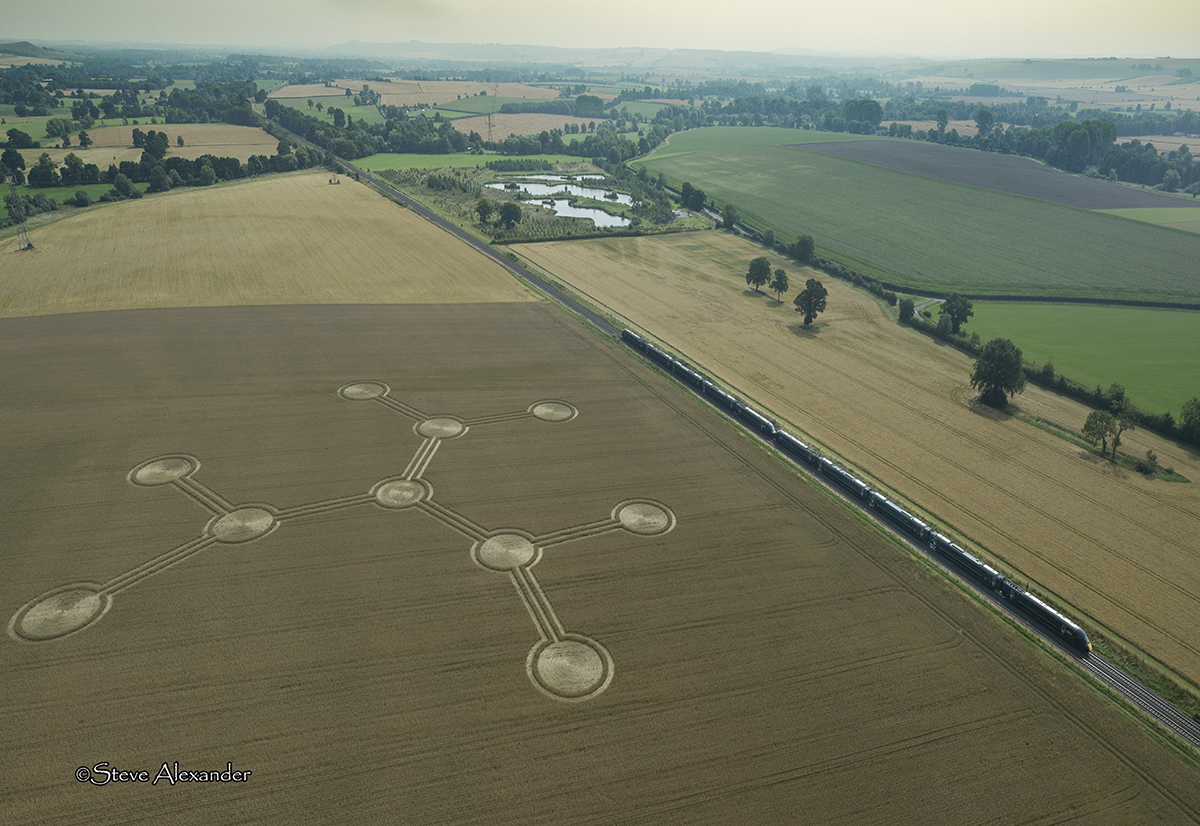
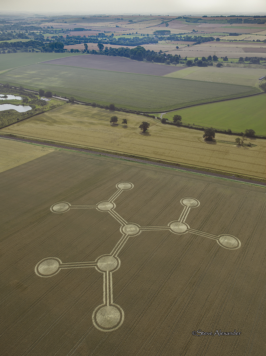
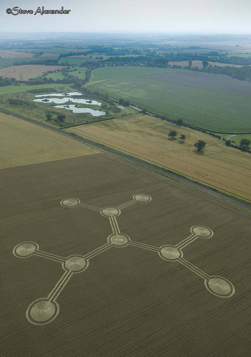
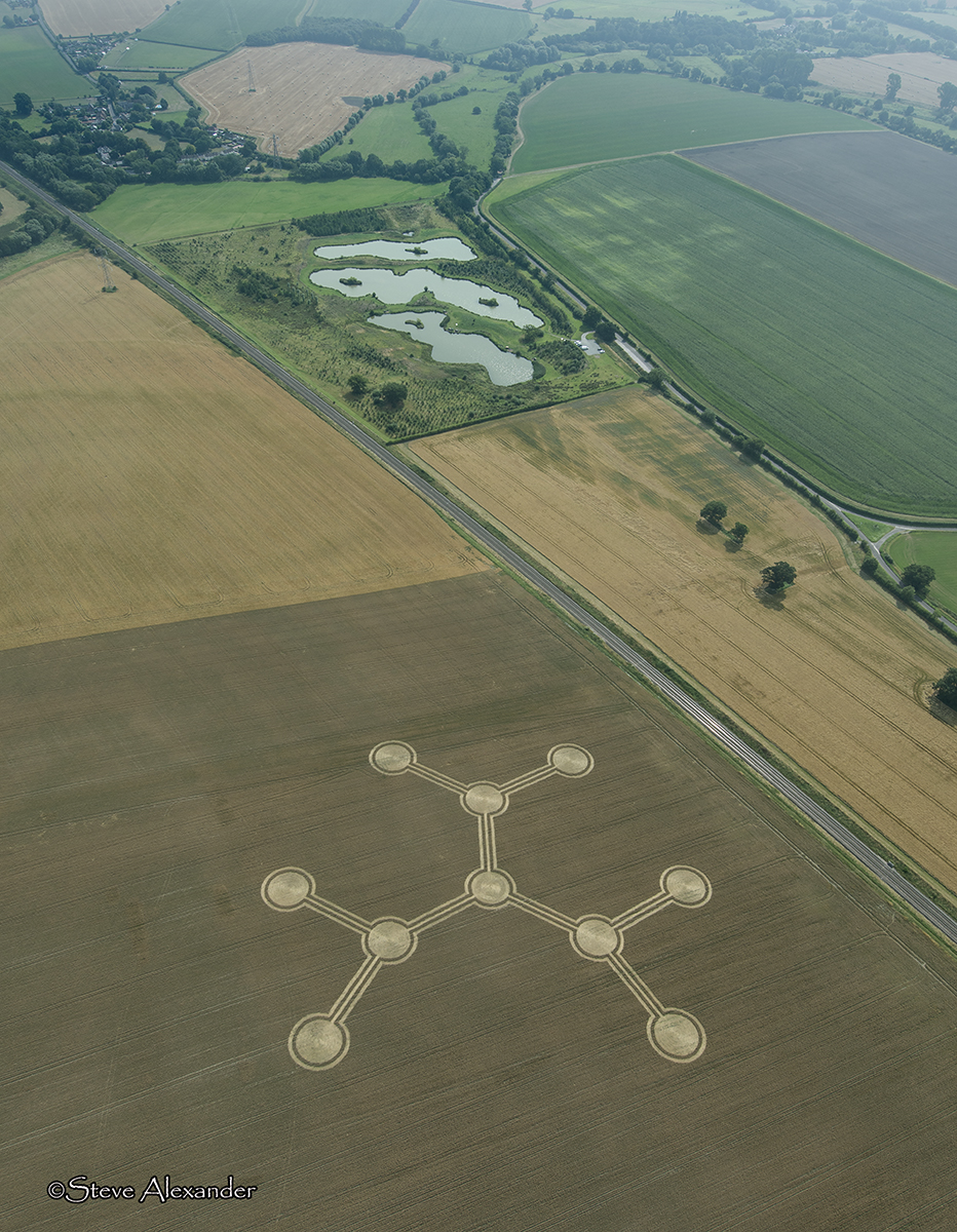
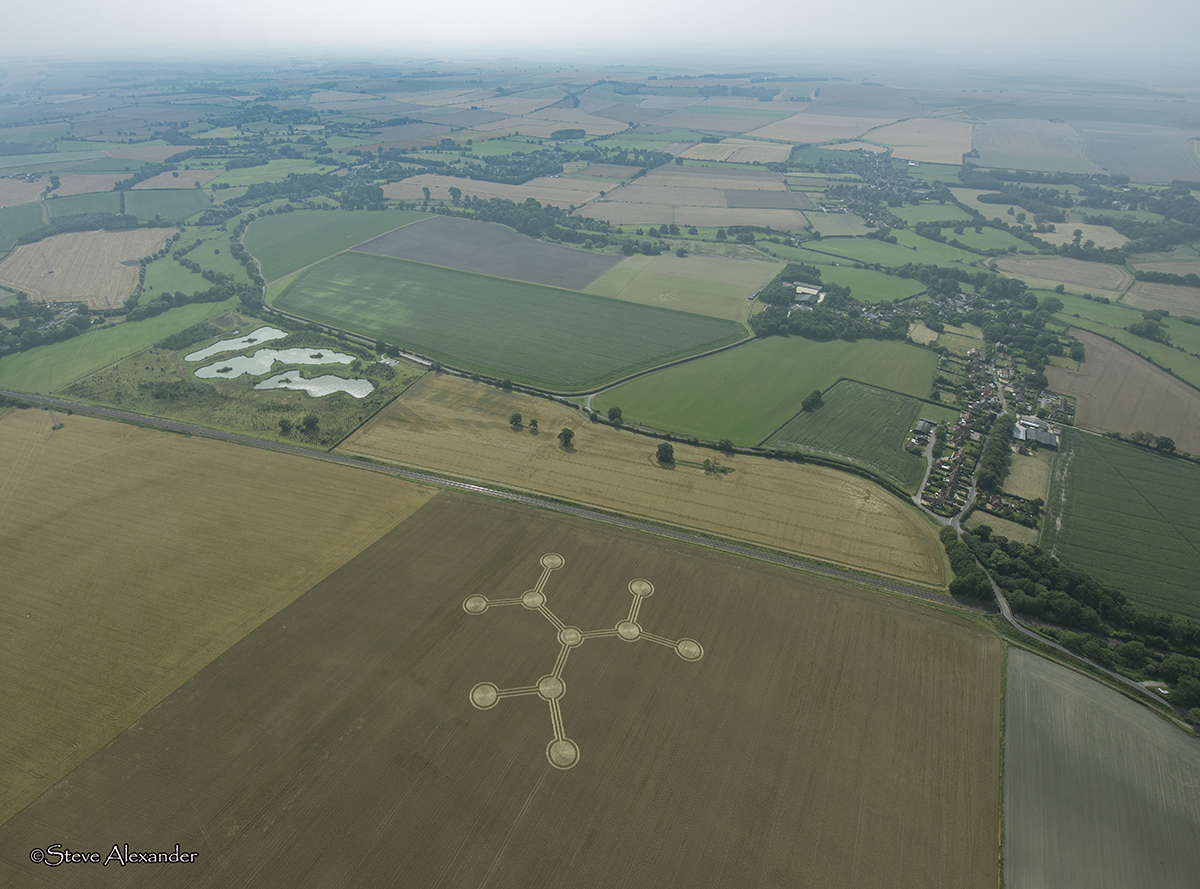
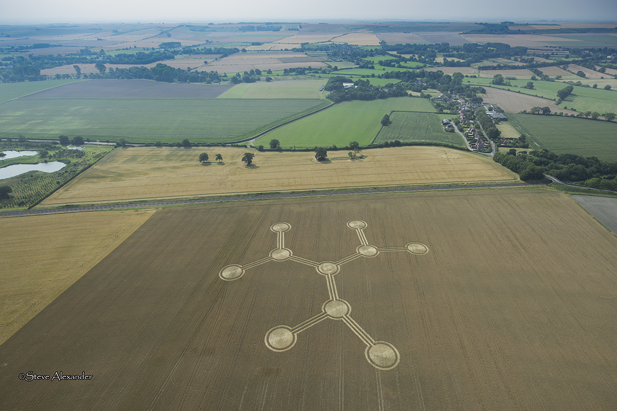
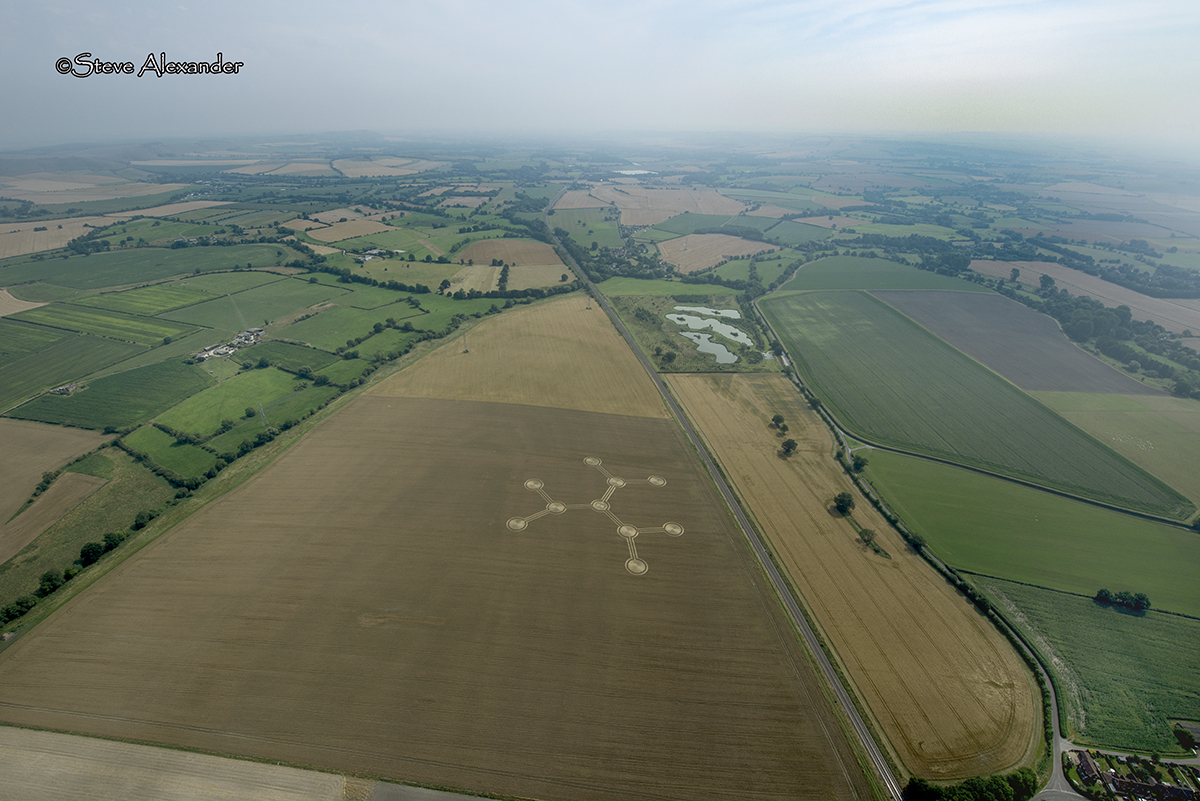
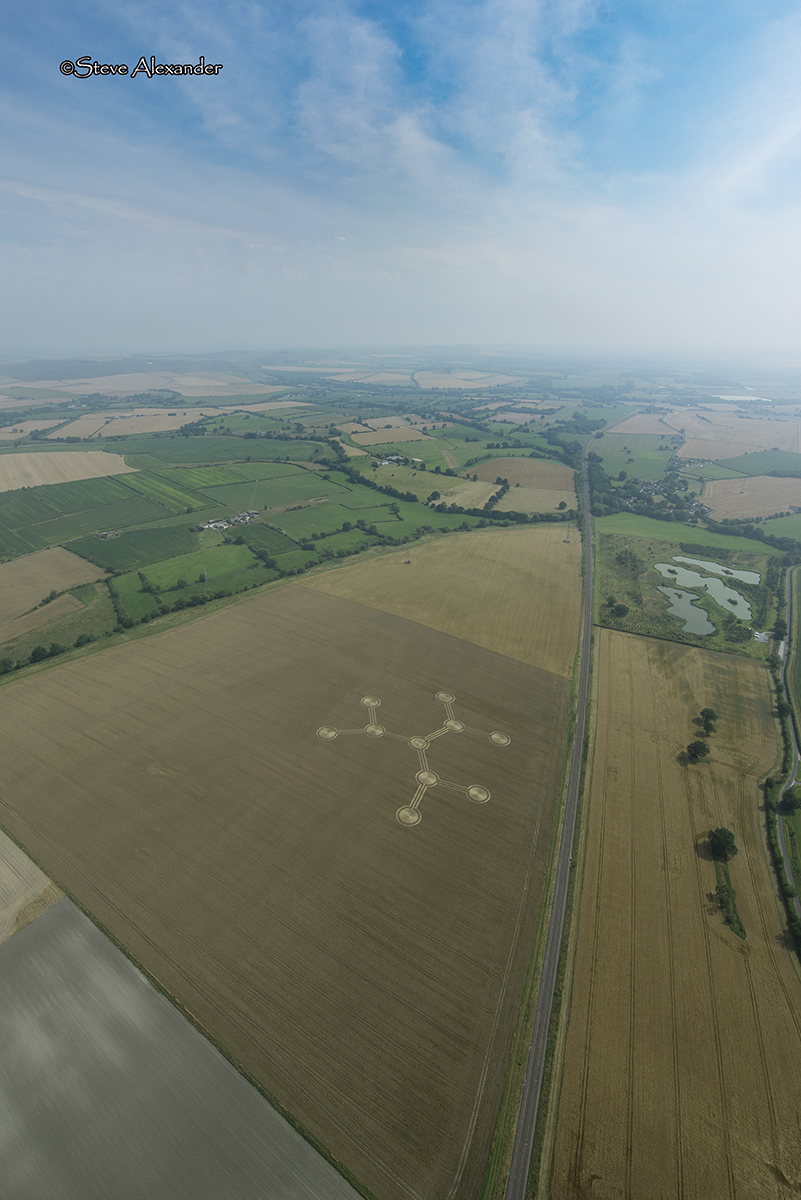

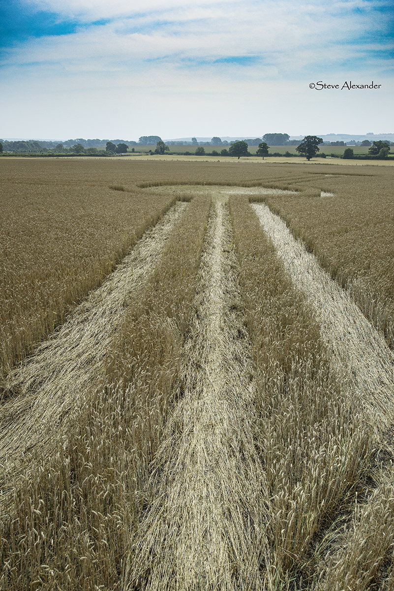
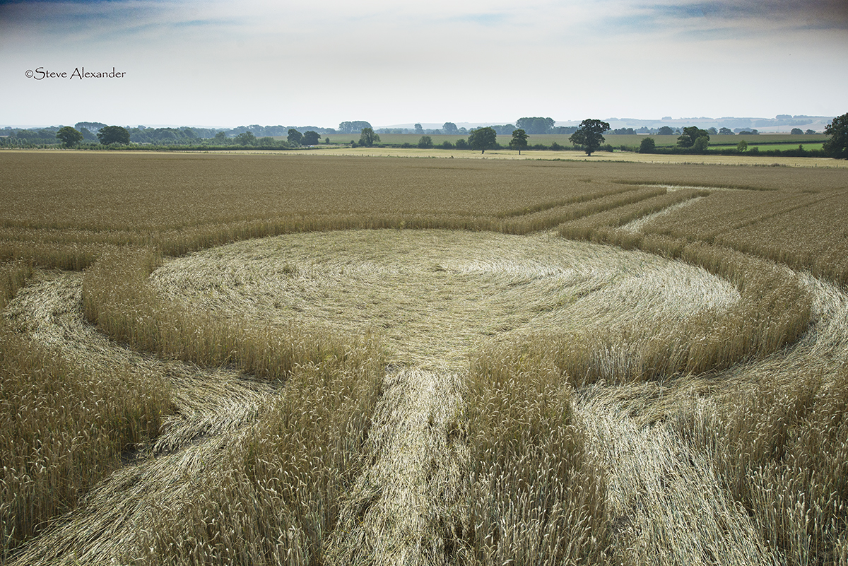
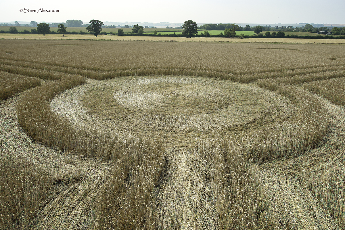
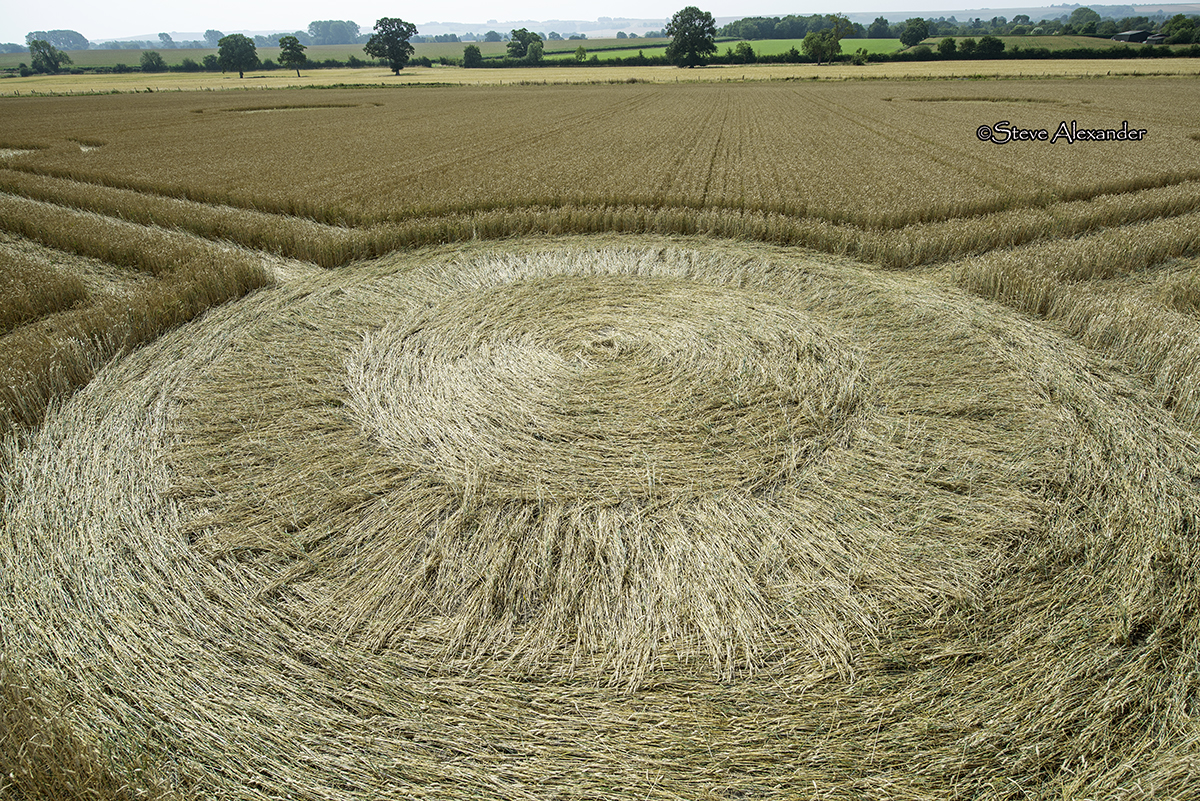
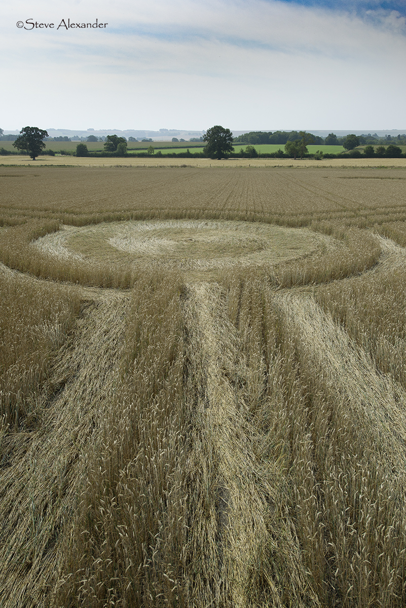
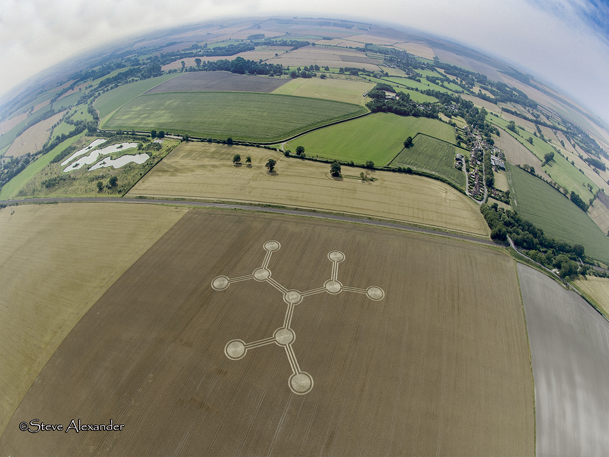
Image Licencing
We can supply high resolution images of many of our photographs and the sky is the limit as to what they can be used for! Choose from our extensive library or contact us to commission aerial photography for your project.
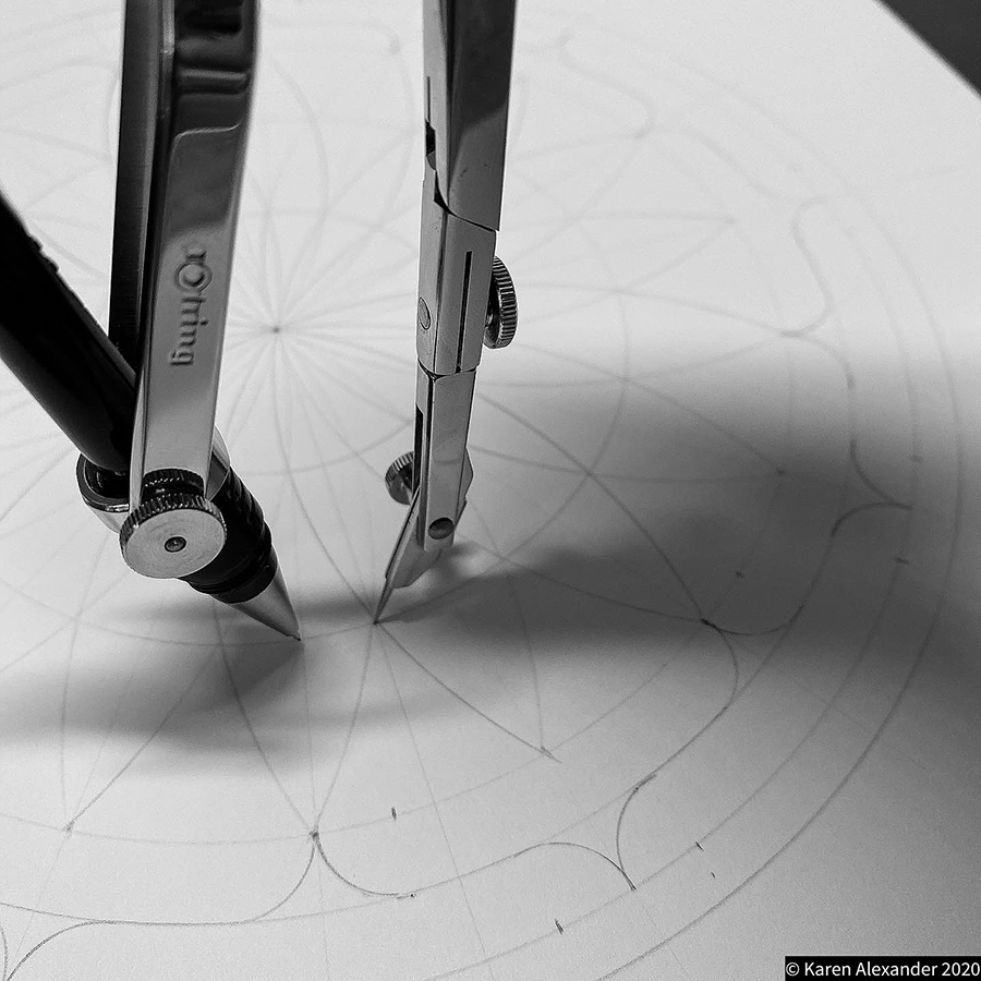
Geometry Gallery
It's on the Drawing Board! Check back later for further drawings and analysis.
Please enjoy the diagram below by Bertold Zugelder.

Date
08.08.2020
Crop
Wheat
Visiting
This crop circle has now been harvested.
Google Maps Link
Further Reading
Find out more on the websites below: