Stonehenge (near visitor centre), Wilts.
(Near Normanton Barrows)
Detail & Location: This circle was first reported on the 14th July 2024 in a field of wheat, not far from the previous circle by the Stonehenge Visitor Centre. Google Maps Link. OS Grid Ref: SU 11418 41219. What-three-words: sublime.corrosive.valid
The circle measures approximately 150ft in diameter.
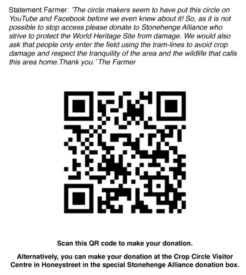 Visiting: The farmer is allowing access to this crop circle and has asked for donations of £5.00 to the Stonehenge Alliance who are campaigning to stop the proposed traffic tunnel beneath Stonehenge. You can read more about the campaign here. You can make a donation using the QR code (left). Please be aware, this crop circle has very little room for visitors and will be easily over-crowded and damaged by large groups. The farmer has also asked that people please see to the tractor lines when entering and leaving the field. Please plan your visit accordingly and make sure to leave the crop circle as you found it, for others to enjoy.
Location & History: Stonehenge is a UNESCO world heritage site and is famous the word over. It has been the site of many, many crop circles cover the past 30 years. You can read more about Stonehenge on the English Heritage website.
About this crop circle: This crop circle is the second of 2024 to reference the Quintuplet (the first being at Wilton Windmill). Only this time the design is presented with a square connecting four circles of the same size placed at 90 degrees. Strictly speaking, this isn’t a classic quintuplet as it has no centre circle, instead it has an empty of invisible centre. This, then, also adds this crop circle to a growing list of recent crop circles that have no centres at all. I’ll be discussing these points and more in my write-up very soon. Check back on this page for updates.
Please see the Geometry Gallery below for more details as we have them.
Visiting the Circles? If you are thinking of visiting any crop circles this summer, please read our Visiting the Crop Circles section. It’s full of useful information and etiquette for visiting the countryside and the crop circles. Please remember that you should not enter any fields without the express permission of the farmer.
Click here for Copyright Information about the reproduction of images on this website.
Please Help to keep us Flying in 2024: We hope to take to the skies again in 2024 to record the circles that appear this summer. If you have enjoyed looking at our pictures and information please consider making a small donation to keep us flying. There are so few of us left regularly recording the circles it’s really important that we continue. And while some now use drones to record the circles, it is important that there are still images taken from aircraft where the best quality camera equipment can be used and images that include the broad vista of the landscape can be taken. This kind of photography is expensive and it gets harder with each passing year to raise the funds we need to continue our work, but if everyone who regularly looked at this website made a small donation we would meet the funds we need. You can make a donation here.
NOTE: Some of the images below are beautiful landscape scenes. Click on each image to enlarge them and see the whole picture.
IMAGES: By Steve Alexander unless otherwise indicated.
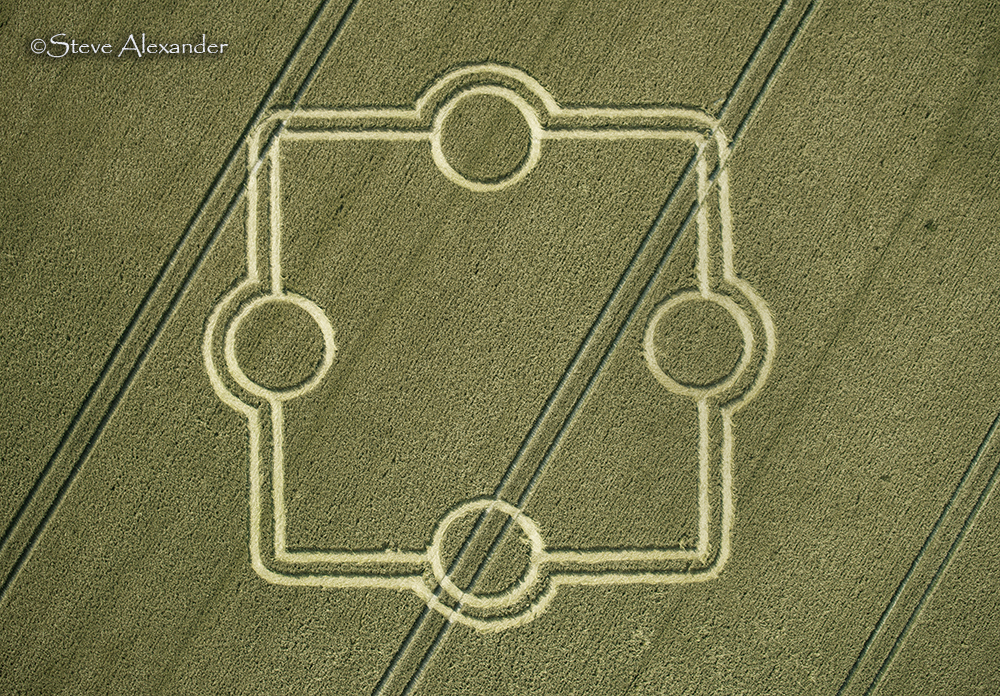
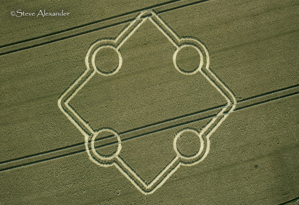
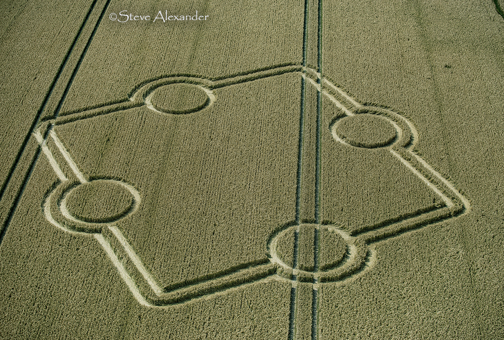
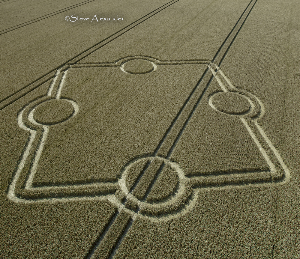
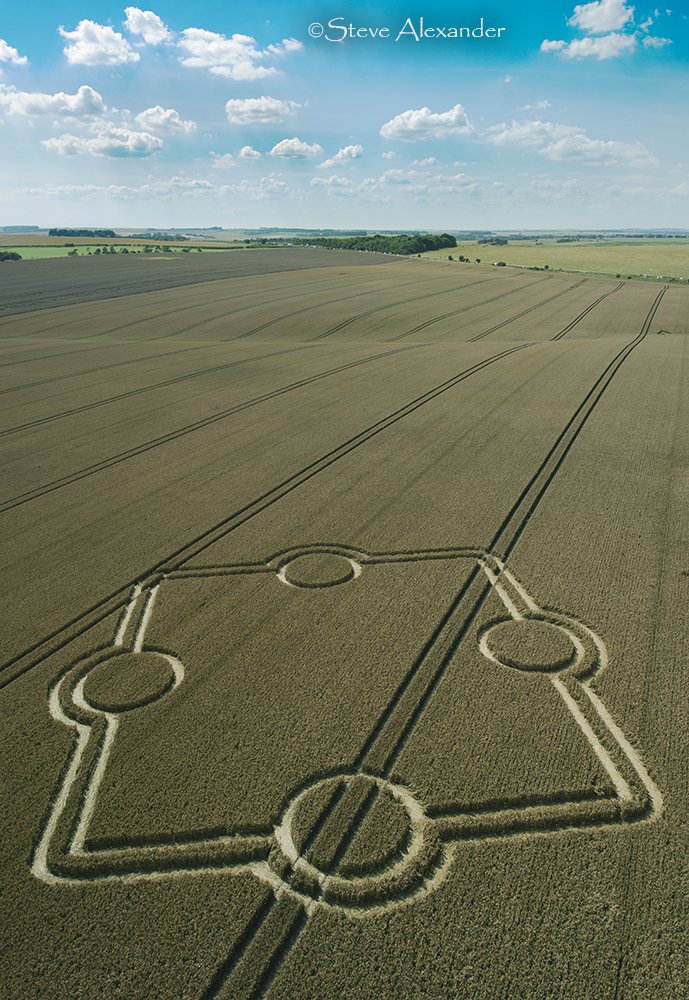
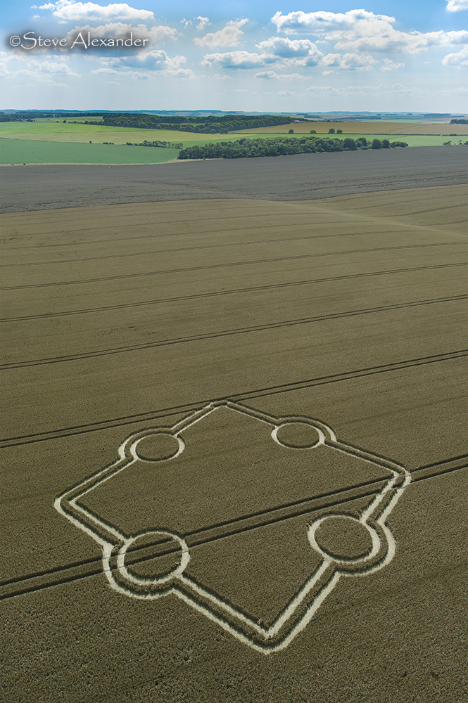
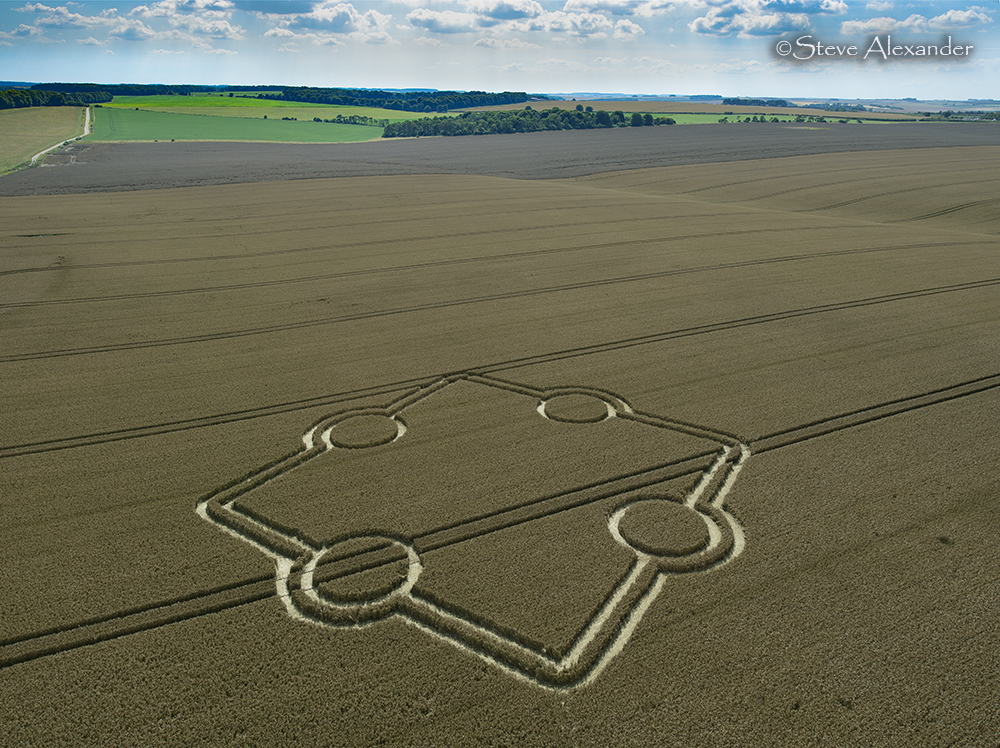
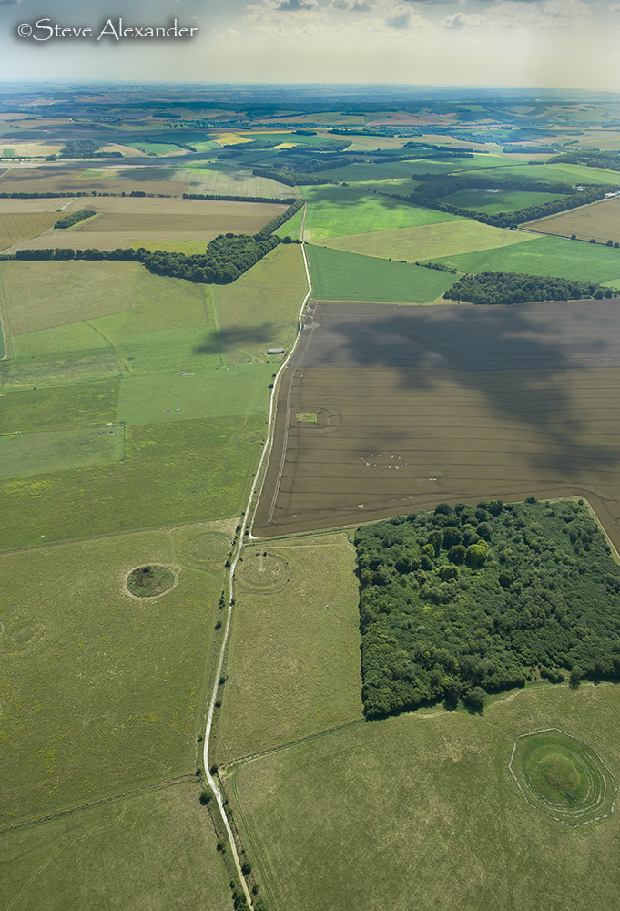
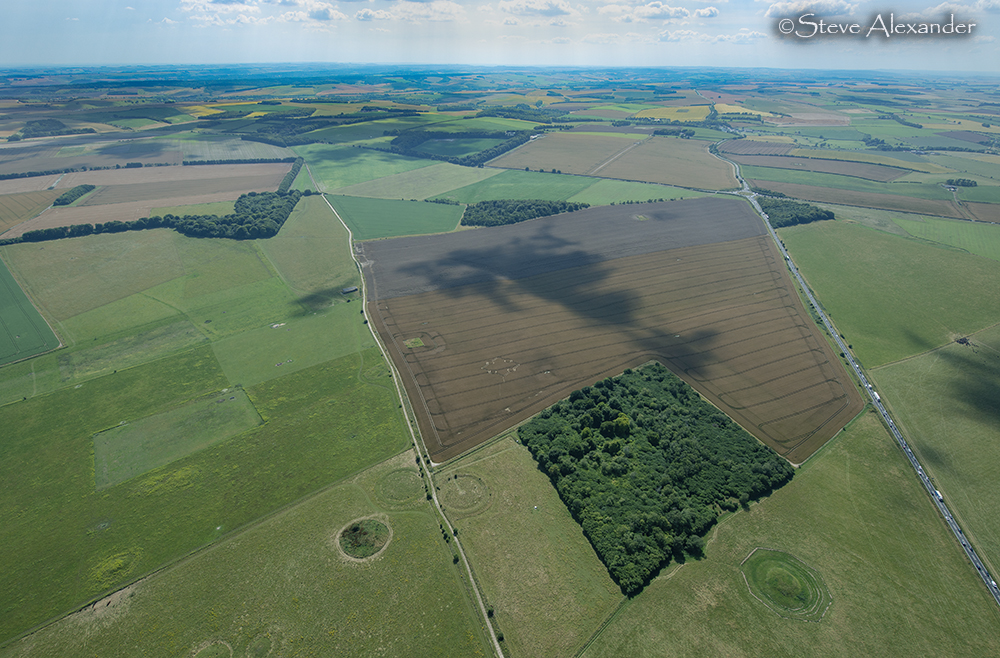
Image Licencing
We can supply high resolution images of many of our photographs and the sky is the limit as to what they can be used for! Choose from our extensive library or contact us to commission aerial photography for your project.
Geometry Gallery
It's on the drawing board! Check back for updates.
Date
14.07.2024
Crop
Wheat
Visiting
Google Maps Link. OS Grid Ref: SU 11418 41219
Permission has been granted for access to this crop circle. Please see the main text on this page for details of how to make your donation for your visit. Thanks!
Further Reading
Find out more on the websites below: