Jack’s Plantation, Bruton, Wilts.
(South Brewham, Bruton – close to Alfred’s Tower).
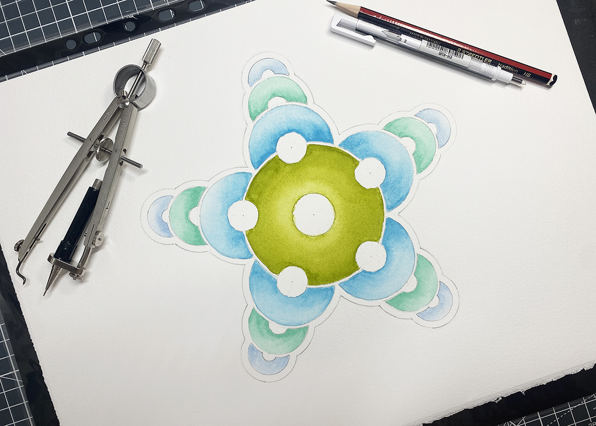
Introduction: This crop circle was first reported on the 8th of May 2026 in a field of young barley. It measures approximately 200ft in width.
Location details: Google Maps Link OS Grid Ref: ST 74957 35471. What-three-words: piled.surfed.noble
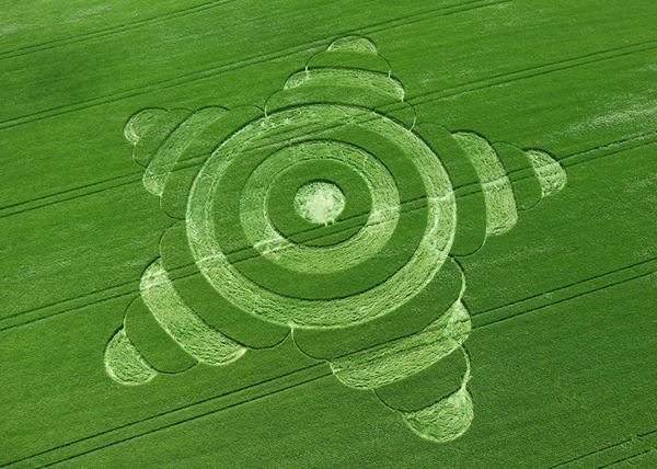
Morgan’s Hill 2007
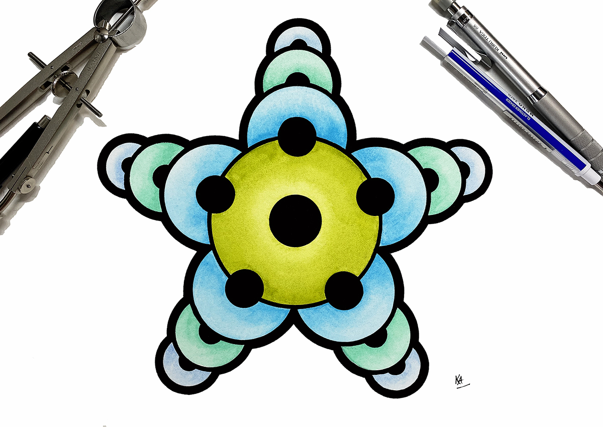
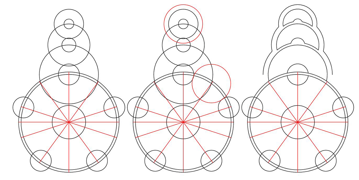
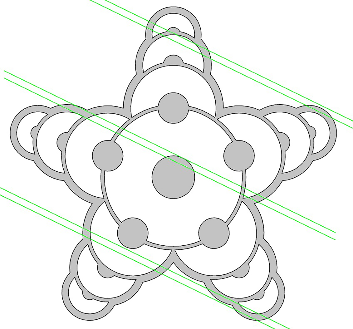
Description: This crop circle is a five-fold (armed) design, based on the pentagram star. Each arm of the star contains a stack of three partially overlaid circles of diminishing sizes towards their points. Each of those three circles also has a small circle in their centre, which also diminishes in size.
The design is centred upon a central ring with five small circles places equidistantly. This could be seen as a riff on the classic quintuplet design – however the quintuplet is fourfold, not fivefold like this design.
Connections: It is very similar to a circle that appeared in 2007 at Morgan’s Hill in Wiltshire (also in Barley). Shown left.
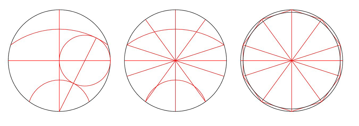
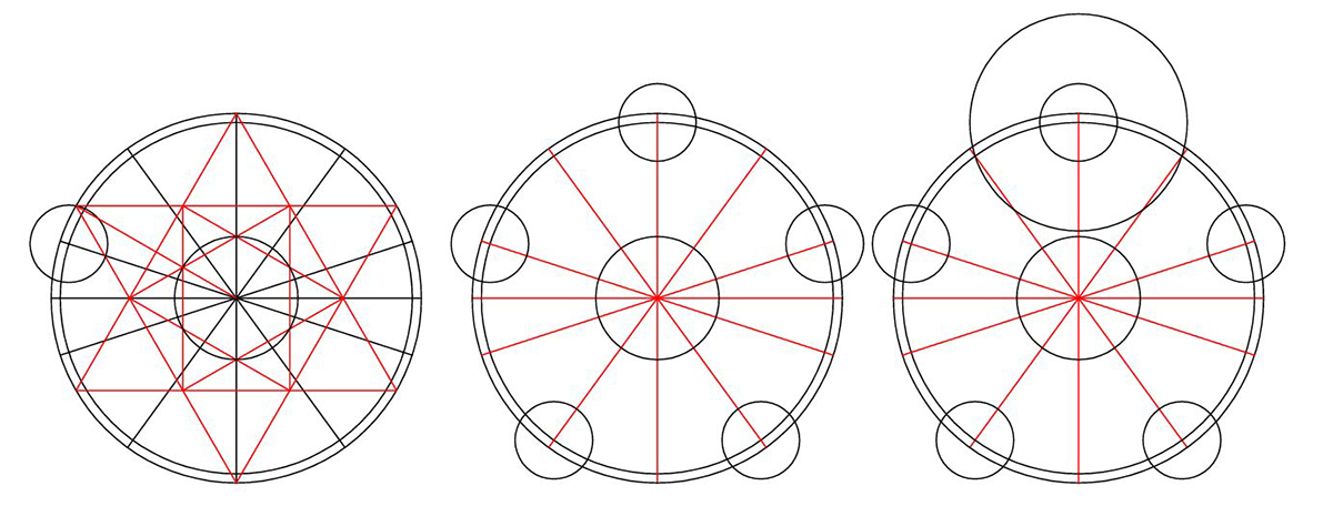
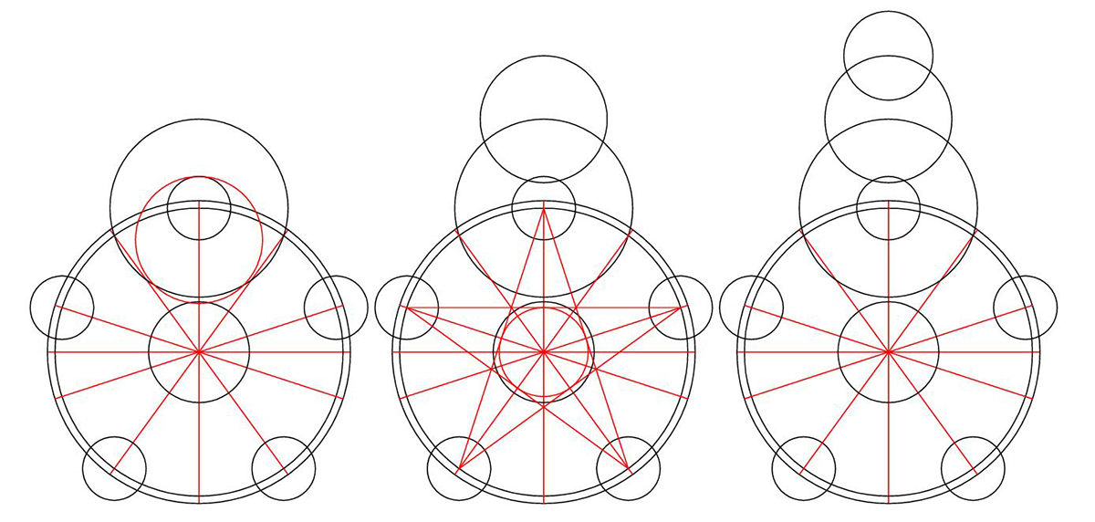
Researcher Peter van den Burg has discovered a hiddlen sixfold proprtioning in this pattern. See the Geometry Gallery below for his analysis.
Flight: We are still fund-raising to fly this season, if you’d like to make a donation to our flight fund, you can do that here. In the meantime, you can see some lovely drone images by Billy Breen and Tomasz Kaczmarek below and some interior shots of the formation, which looks beautiful on the ground. We are enormously grateful to Billy & Tomasz for sharing their images with us.
Visiting: Please do not enter the field without seeking permission from the farmer. Please read our Visiting the Crop Circles section for a downloadable PDF about visiting the crop circles.
Inside the crop circle: We would like to thank Billy Breen, Tomasz Kaczmarek & Dan Vidler for their fantastic interior shots of this circle in the gallery below.
Location History: This crop circle lies very close to a number of interesting historical geographic features. The first is Alfred’s Tower (you can see this in a number of photos in the photo gallery below).
About Alfred’s Tower
This triangular tower, two miles north-west of Stourhead garden, was designed by Henry Flitcroft for Stourhead’s second owner, Sir Henry Hoare II. The Tower is named after King Alfred who raised his standard here in 878. The tower commemorates the accession of George III in 1760 and the end of the Seven Years’ War.
You can read more about the tower on the National Trust website – here.
In the trees close to crop circle there is also Jack’s Castle, complete with ancient tumulus. And finally, there is St. Peter’s Pump to the west. You can read about all these places in the following links: Jack’s Castle | St. Peters Pump.
General Information:
Visiting the Circles? If you are thinking of visiting any crop circles this summer, please read our Visiting the Crop Circles section. It’s full of useful information and etiquette for visiting the countryside and the crop circles. Please remember that you should not enter any field without the express permission of the farmer.
Click here for Copyright Information about the reproduction of images on this website.
Please Help to keep us Flying in 2026: We hope to take to the skies again in 2026 to record the circles that appear this summer. If you have enjoyed looking at our pictures and information please consider making a small donation to keep us flying. There are so few of us left regularly recording the circles it’s really important that we continue. And while some now use drones to record the circles, it is important that there are still images taken from aircraft where the best quality camera equipment can be used and images that include the broad vista of the landscape can be taken. This kind of photography is expensive and it gets harder with each passing year to raise the funds we need to continue our work, but if everyone who regularly looked at this website made a small donation we would meet the funds we need. You can make a donation here.
NOTE: Some of the images below are beautiful landscape scenes. Click on each image to enlarge them and see the whole picture.
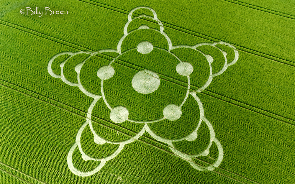
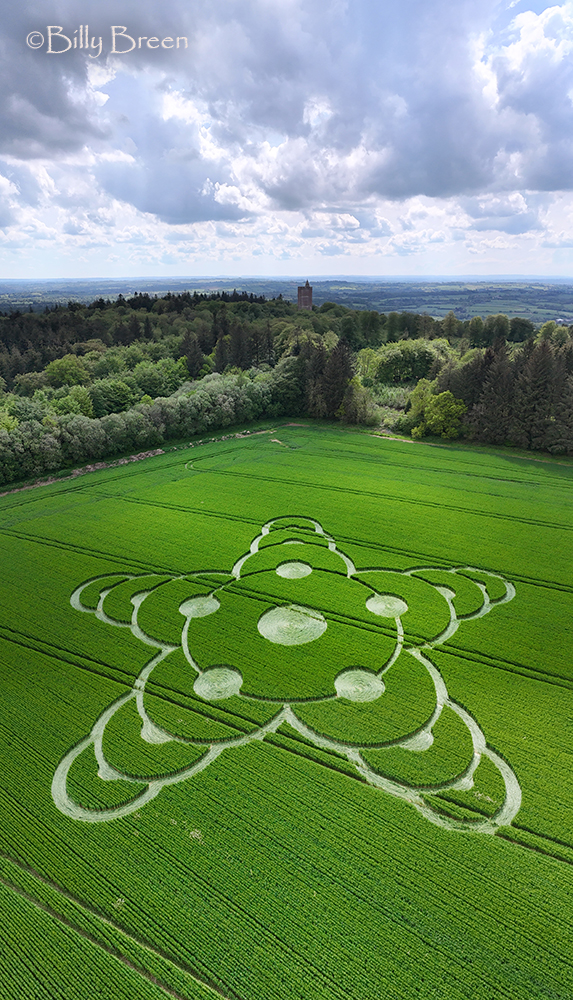
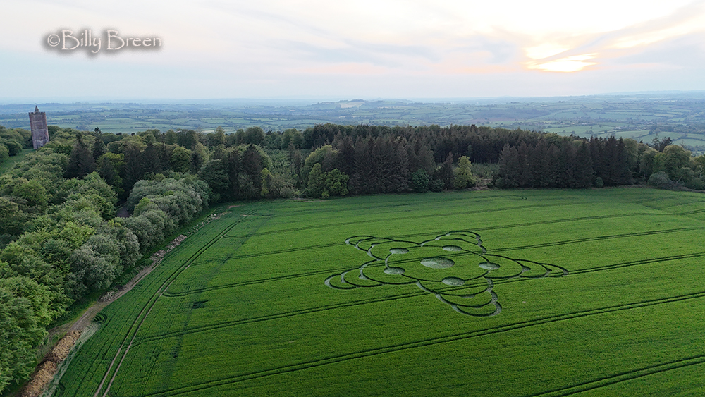
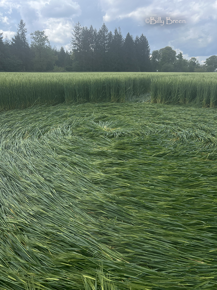
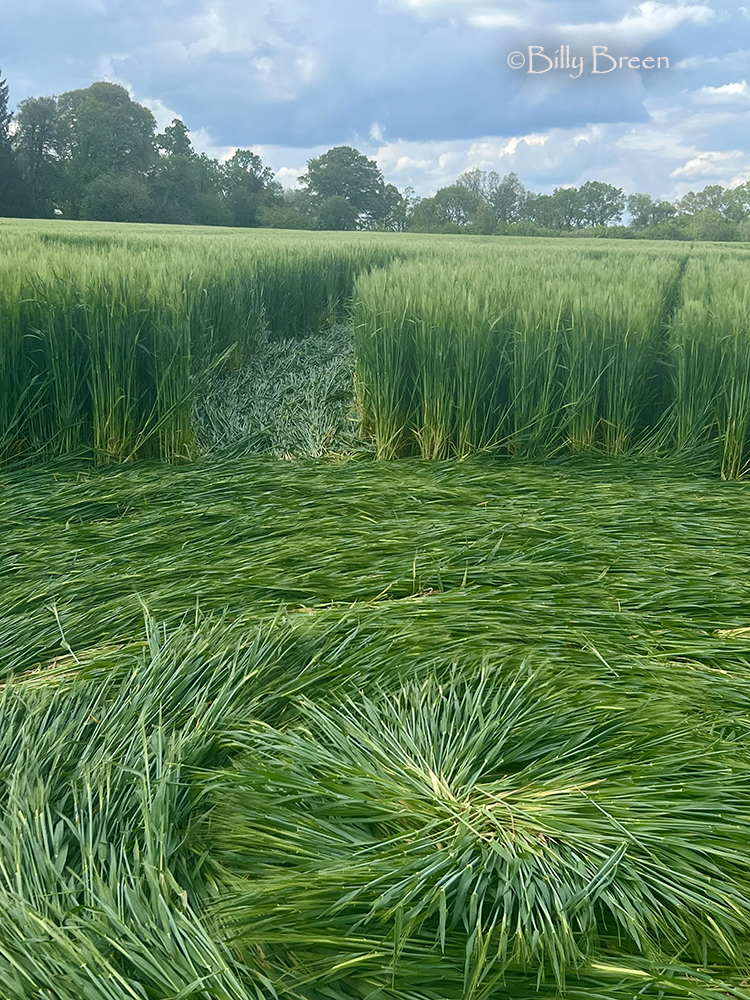
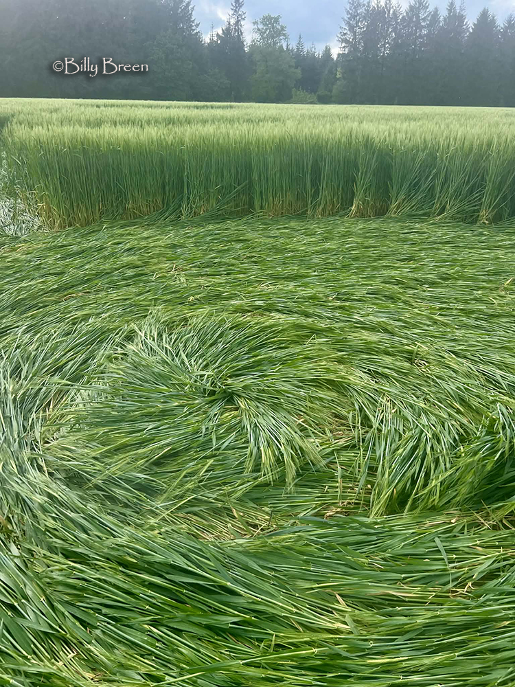
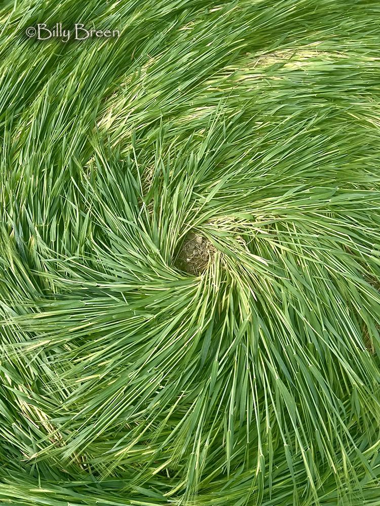
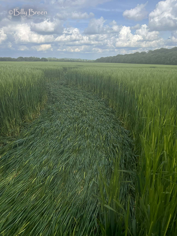
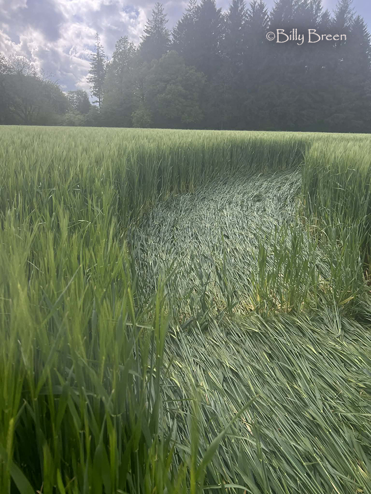
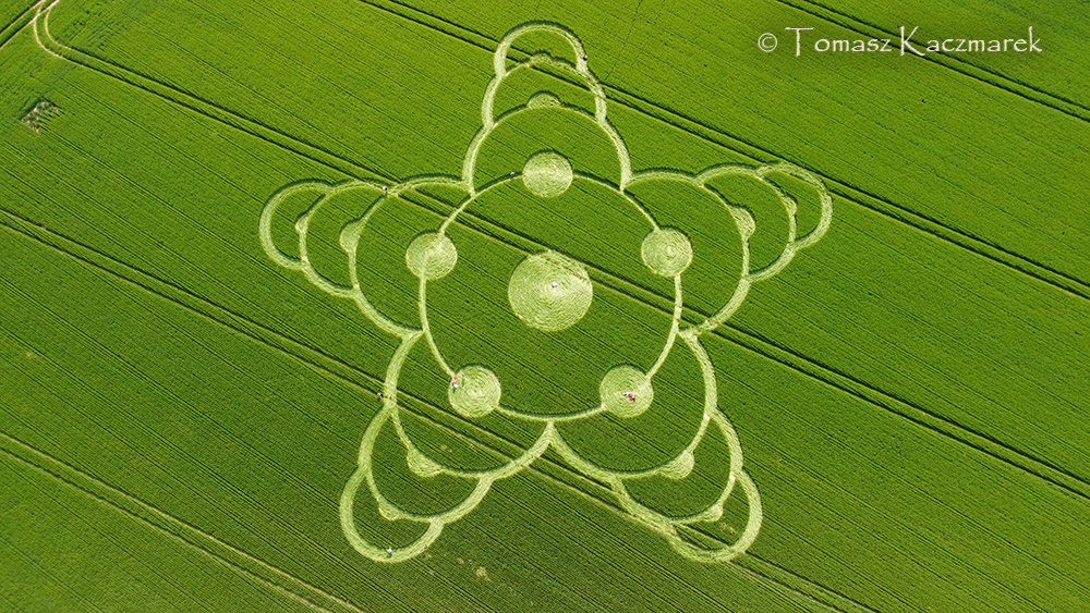
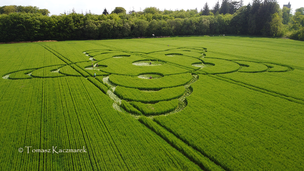
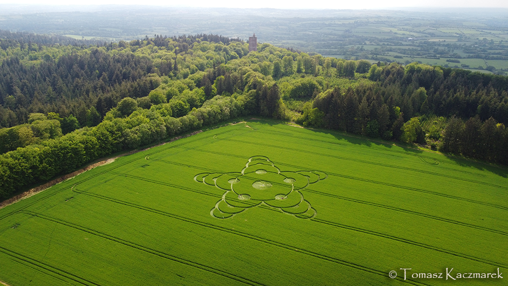
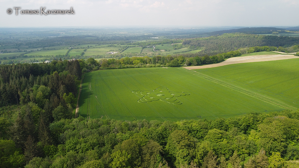
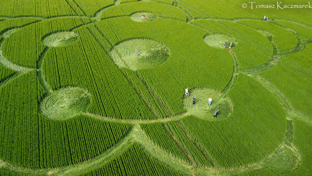
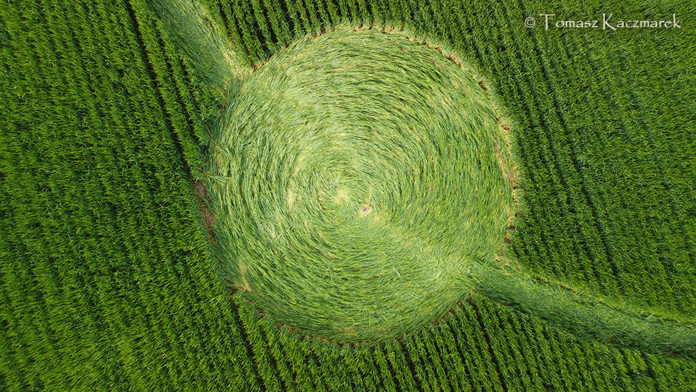
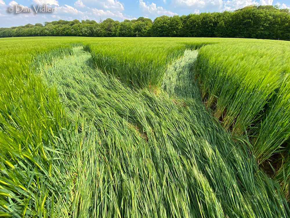


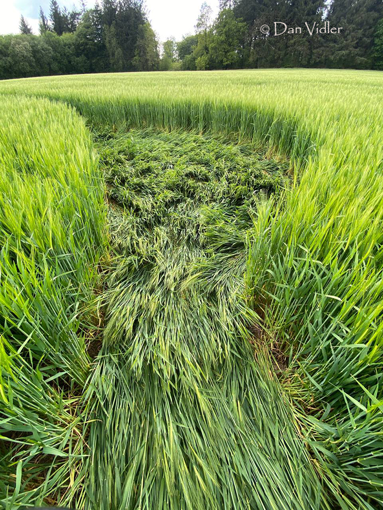

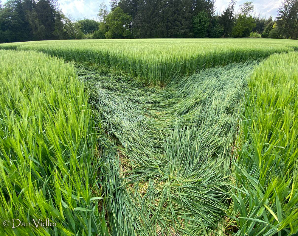
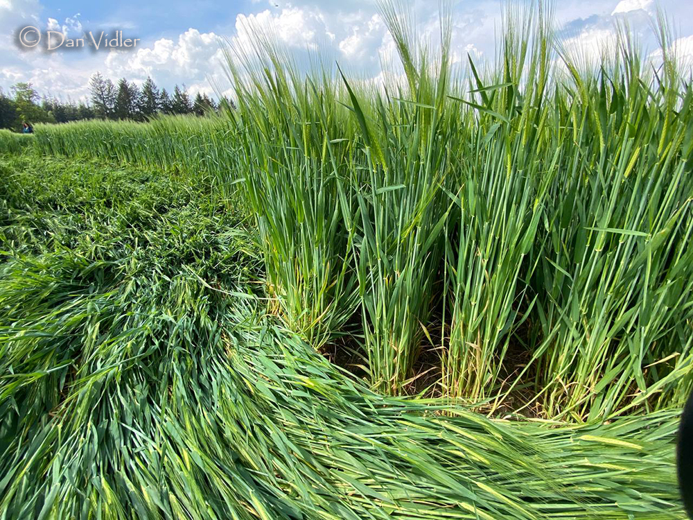
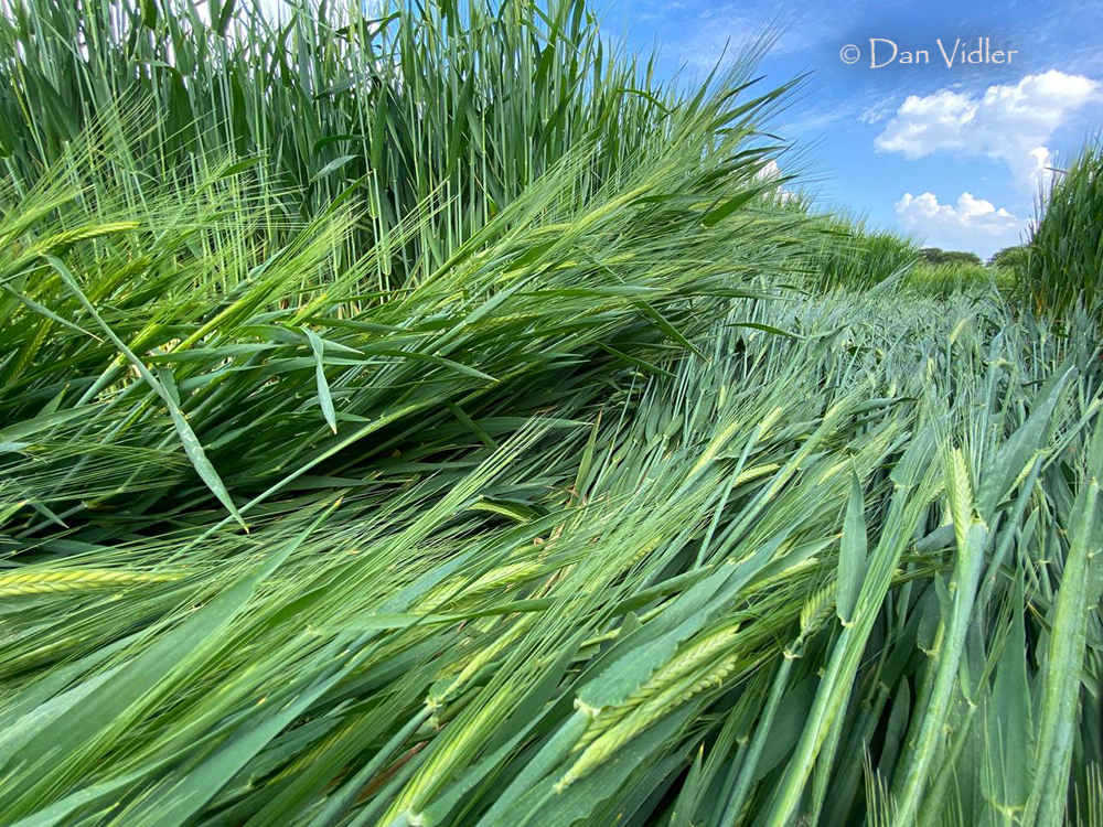
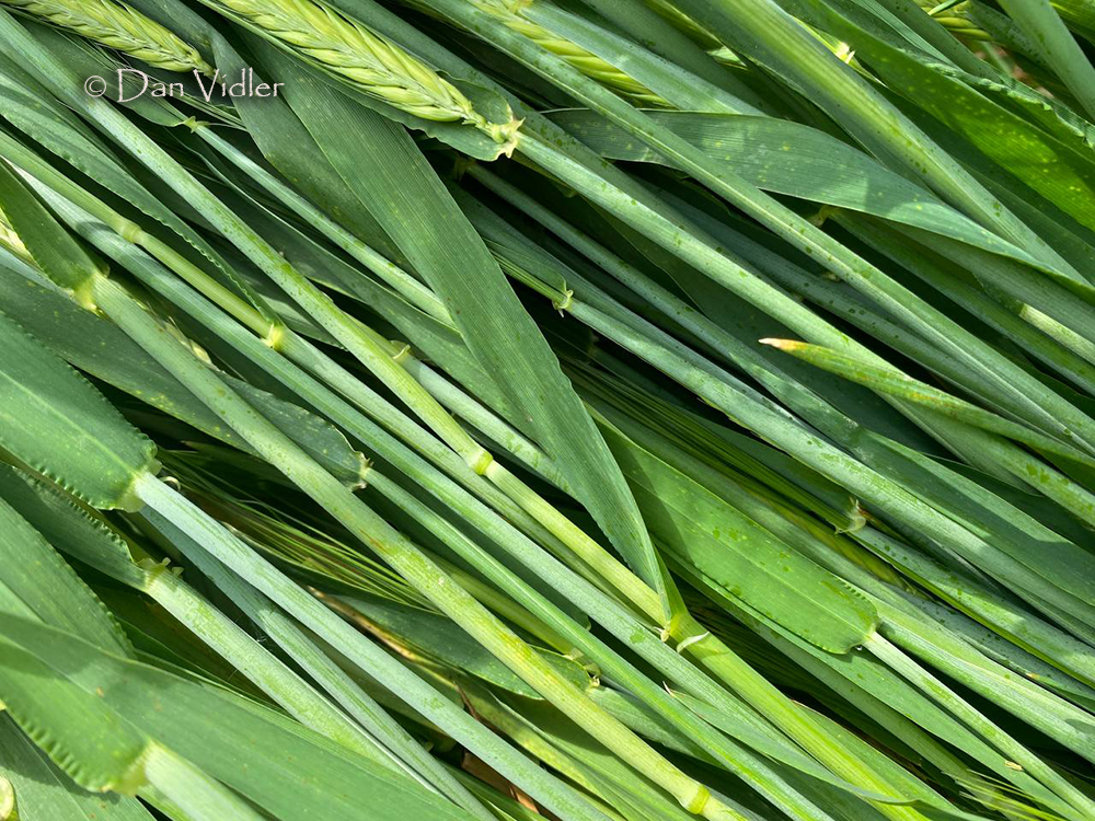
Image Licencing
We can supply high resolution images of many of our photographs and the sky is the limit as to what they can be used for! Choose from our extensive library or contact us to commission aerial photography for your project.
Geometry Gallery
You can read read more of Peter's excellent work on his Facebook Page Geometry of the Crop Circles.

Date
08.05.2026
Crop
Barley
Visiting
Google Maps Link OS Grid Ref: ST 74957 35471. What-three-words: piled.surfed.noble
You will need permission to visit this field from the farmer.
Further Reading
Find out more on the websites below: