
Chirton, Wiltshire.
(Near Chirton Bottom)
Detail & Location: This circle was reported on the 5th of September. It is in a field of wheat and measures approximately 120ft in diameter. See the Google Maps link for precise location.
Crop Circle Reporting and Covid-19: After considerable thought and consultation, we have decided we will not be censoring crop circle locations during the Covid-19 pandemic. There are no current restrictions in place in the UK that call for a blanket ban on visiting the countryside. We consider the reporting of crop circles to be in the spirit of journalism, and censorship to be an anathema to that spirit. Therefore, we will be treating the crop circle community as adults and asking everyone to approach the information carefully and responsibly. This will include not visiting the circles if the farmer has not given explicit permission to do so and should permission be given that they practice social distancing by staying 2 metres away from fellow visitors. It would be our very strong advice that visiting the crop circles on the ground should be kept to an absolute minimum for now. However, because we know that the location of any given circle can be important to researchers and those that record the circles from the air, we will continue to share what we know.
Flying during the Covid-19 Pandemic: Thanks to the hard work of all at Heliair, Thruxton, as of July 20th we have been able to return to the air to record the 2020 circles. We will still be working along-side the excellent AEROBO (Art in Flight) who will be helping us collect images and drone footage of the latest crop circles to share on the website.
Visiting: As far as we are aware no permission has been given to visit this crop circle. Please do not visit this circle. Thank you.
History & Connections: The location of this circle lies close to the Salisbury plain danger area and while it is not in the danger area if you are on foot, if you are flying you are in the airspace which extends further in the air than on the ground. You will need permission to fly over this circle. The circle is located not far from the White Horse trail, close to Chirton Down and Marden Down. Both nearby Chirton and Urchfont have had crop circles before.
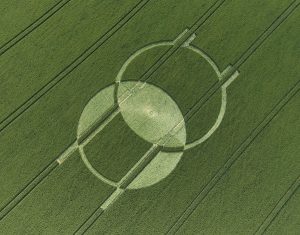 Design & Symbolism: This new crop circle has some similarities to the circle that appeared at Horton in 2008. The Horton circle was a Vesica (twoness), whereas Chirton is a single circle (unity) – the similarities lie in the use of the tractor lines as an integral part of the design.
Michael wrote a blog about several circles that happened at Horton where he lived, including the one in 2008. You can read the blog here.
The circle at Chirton is interesting as the design seems to be dealing with mirror images and duality, similar themes to the Horton circle.
Visiting the Circles? If you are thinking of visiting any crop circles this summer, please read our Visiting the Crop Circles section. It’s full of useful information and etiquette for visiting the countryside and the crop circles. Please remember that you should not enter any fields without the express permission of the farmer and you will need to be aware of and abide by any restrictions in place in the UK in response to the Covid-19 pandemic.
Click here for Copyright Information about the reproduction of images on this website.
Please Help to keep us Flying in 2020 & Beyond: If you have enjoyed looking at our pictures and information please consider making a small donation to keep us flying. There are so few of us left regularly recording the circles it’s really important that we continue. And while some now use drones to record the circles, it is important that there are still images taken from aircraft where the best quality camera equipment can be used and images that include the broad vista of the landscape can be taken. This kind of photography is expensive and it gets harder with each passing year to raise the funds we need to continue our work, but if everyone who regularly looked at this website made a small donation we would meet the funds we need. You can make a donation here.
NOTE: Some of the images below are beautiful landscape scenes. Click on each image to enlarge them and see the whole picture.


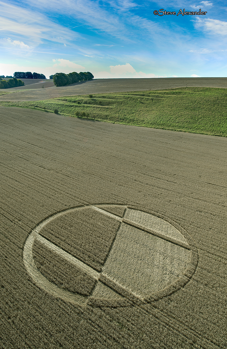

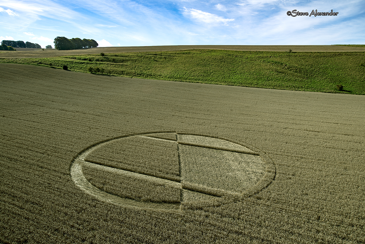
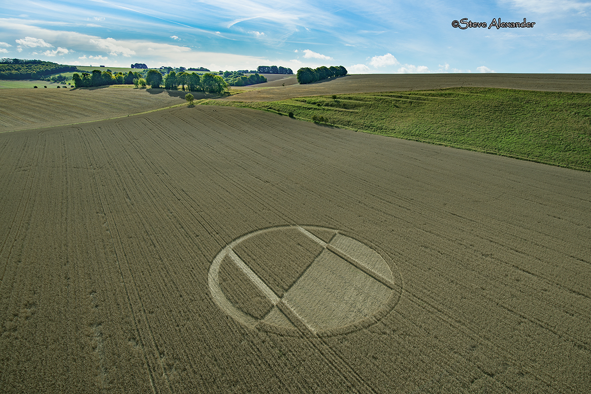
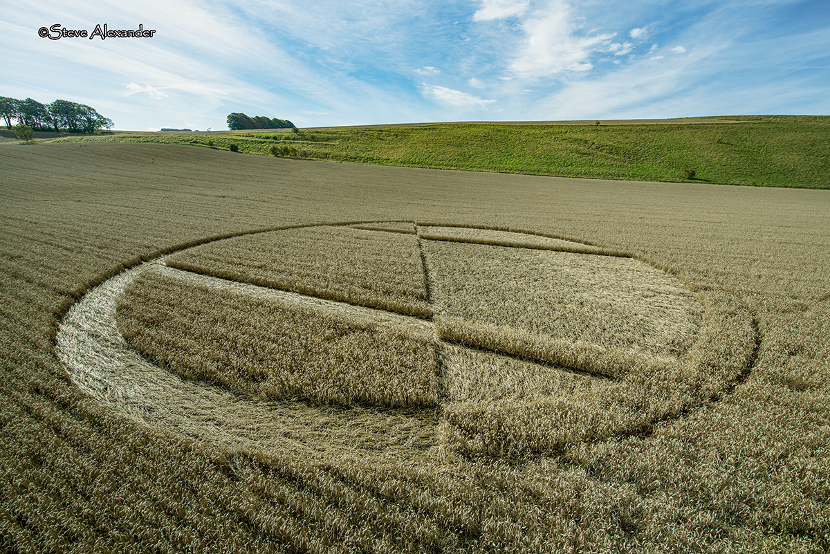


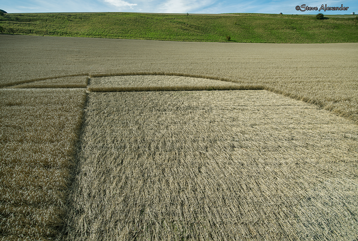
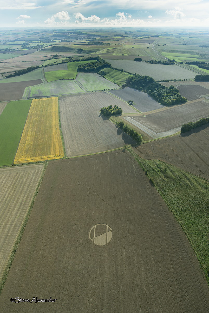
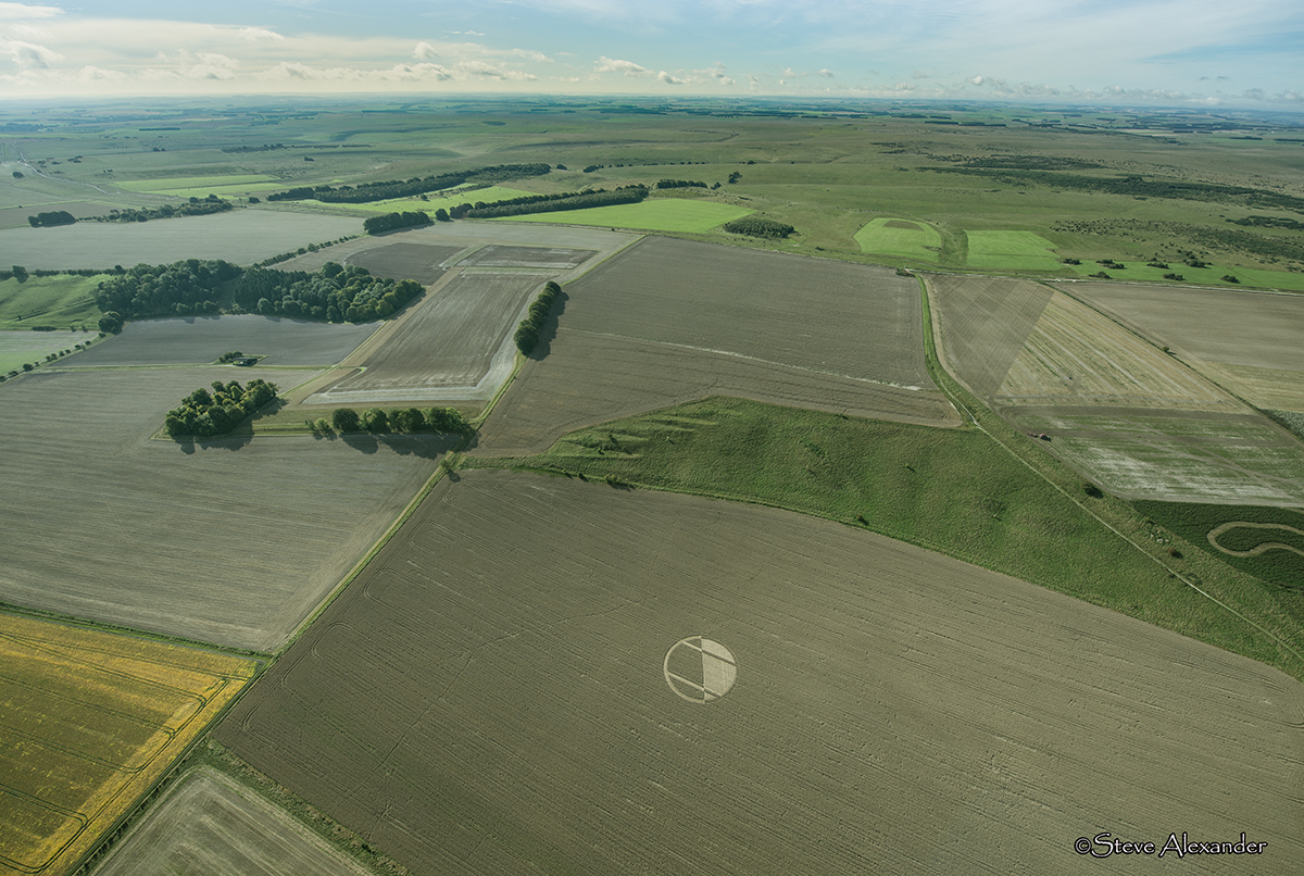
Image Licencing
We can supply high resolution images of many of our photographs and the sky is the limit as to what they can be used for! Choose from our extensive library or contact us to commission aerial photography for your project.
Geometry Gallery
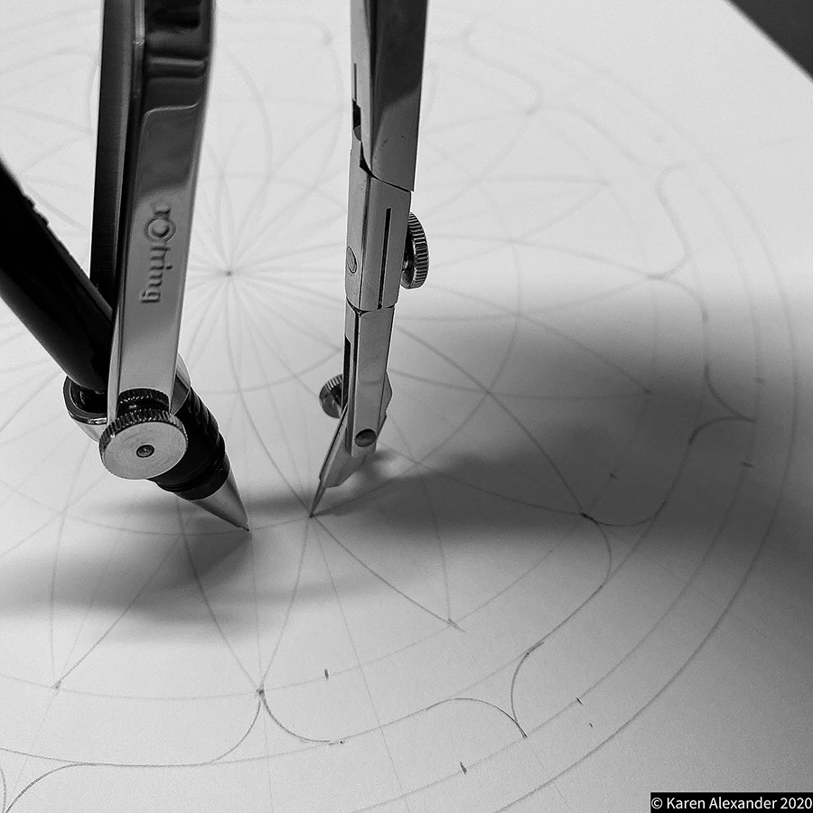
It's on the Drawing Board! Check back later for further drawings and analysis.
Please enjoy the diagram below by Bertold Zugelder.

Date
05.09.2020
Crop
Wheat
Visiting
No permission has been given to enter this circle.
Google Maps Link
Further Reading
Find out more on the websites below: