Ilchester, Somerset.
Bondip Hill (north of A303).
Detail & Location: This crop circle is the first to be reported in the U.K. in 2026. It was first reported on the 4th April in a field of Oilseed rape (canola). It measures approximately 100ft in length.
Google Maps Link. OS Grid Ref: ST 52003 24129. What-three-words: pulses.headstone.lingering
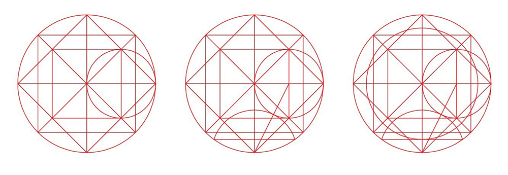
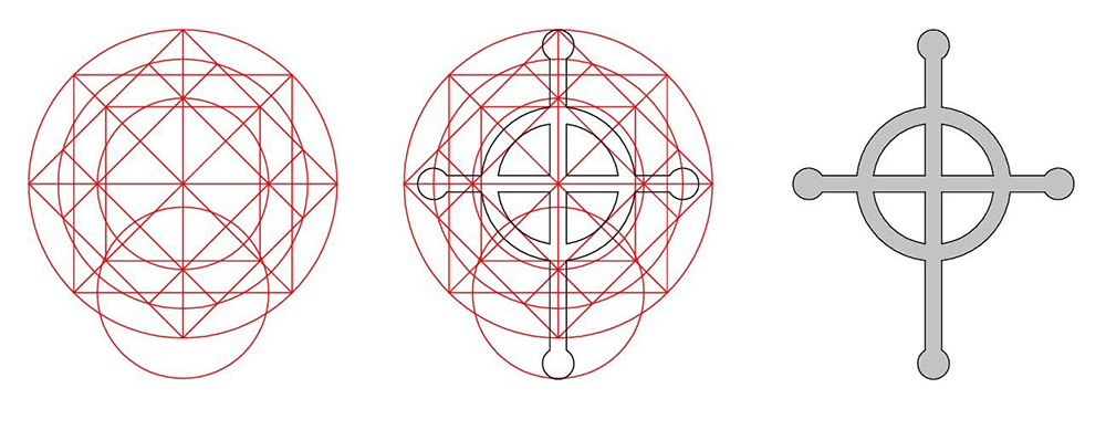
Description: This was a cross shaped formation with a ring, reported on Easter Sunday. It may also have a connection to the recent Artemis Mission to the moon. See the Geometry Gallery below for an analysis by Peter van den Burg.
Flight: We won’t be flying this circle, it’s just too small to cover with an aircraft. However you can see a few drone shots in the picture gallery below.
Visiting: Please do not enter the field without seeking permission from the farmer. Please read our Visiting the Crop Circles section for a downloadable PDF about visiting the crop circles.
Inside the circle (including video): Researcher Dan Vidler was able to take images and video inside this formation. You can see these images in the gallery below – and the video here – many thanks to Dan! You can see more of Dan’s work at: ukcropcircles.co.uk
Additional thanks to Tomasz Kaczmarek for his ground shots also featured below.
Crop Circle at Bondip Hill in 2020
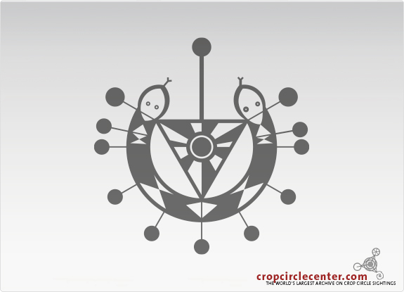
Location & History This circle lies on Bondip Hill, by an old Roman road. There was a circle in this field back in 2020 (25th July/Wheat). See the diagram (left). You can see more about this circle here courtesy of the ‘crop circle center’ database and website. (www.cropcirclecenter.com)
This location is close to Royal Naval Air Station Yovilton. You may need permission to fly a drone in this area – please check.
For information on the geometry and symbolism of this circle, please see the Geometry Gallery below.
Visiting the Circles? If you are thinking of visiting any crop circles this summer, please read our Visiting the Crop Circles section. It’s full of useful information and etiquette for visiting the countryside and the crop circles. Please remember that you should not enter any field without the express permission of the farmer.
Click here for Copyright Information about the reproduction of images on this website.
Please Help to keep us Flying in 2026: We hope to take to the skies again in 2026 to record the circles that appear this summer. If you have enjoyed looking at our pictures and information please consider making a small donation to keep us flying. There are so few of us left regularly recording the circles it’s really important that we continue. And while some now use drones to record the circles, it is important that there are still images taken from aircraft where the best quality camera equipment can be used and images that include the broad vista of the landscape can be taken. This kind of photography is expensive and it gets harder with each passing year to raise the funds we need to continue our work, but if everyone who regularly looked at this website made a small donation we would meet the funds we need. You can make a donation here.
NOTE: Some of the images below are beautiful landscape scenes. Click on each image to enlarge them and see the whole picture.
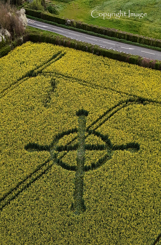
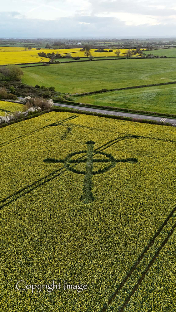
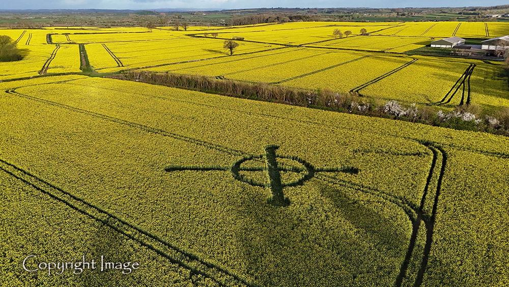
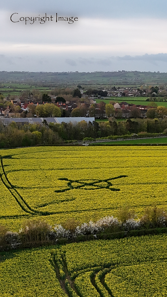
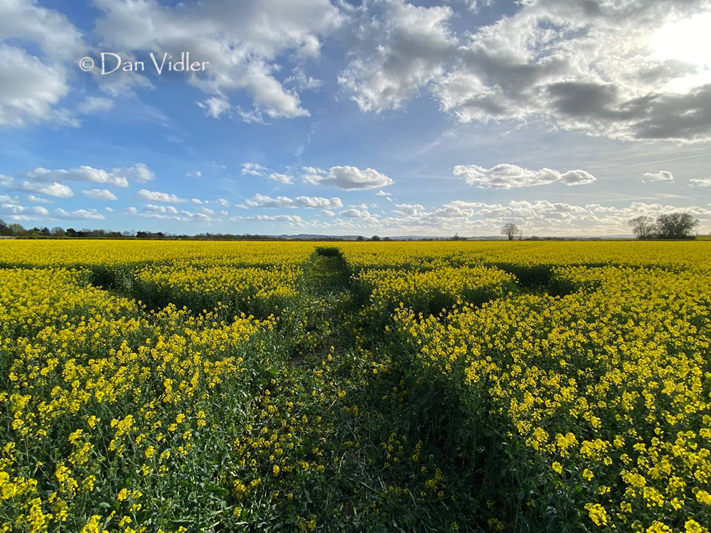
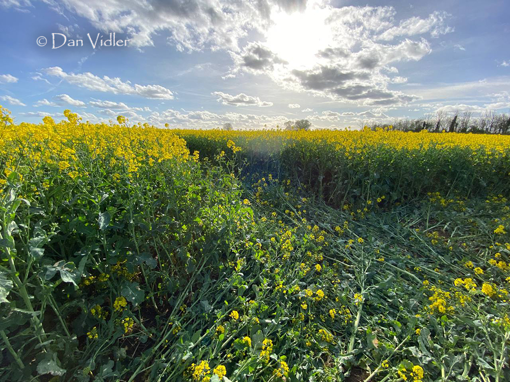
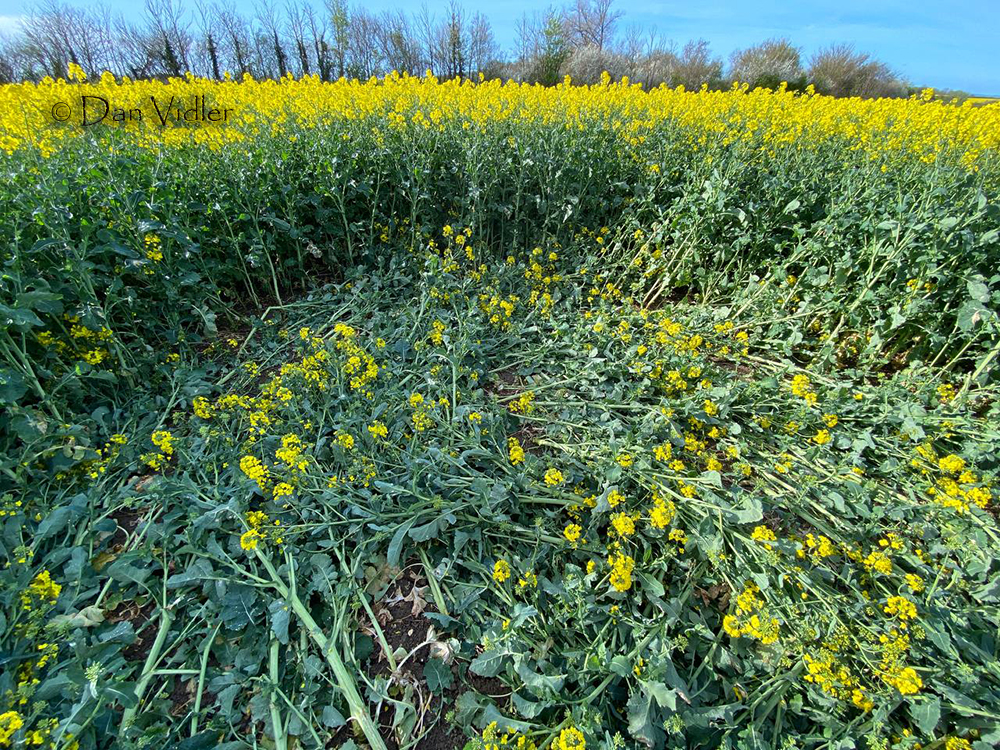
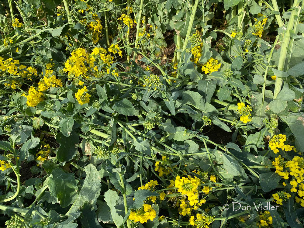
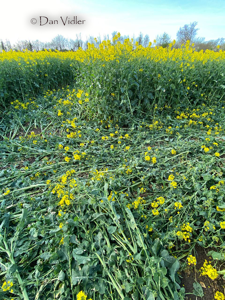
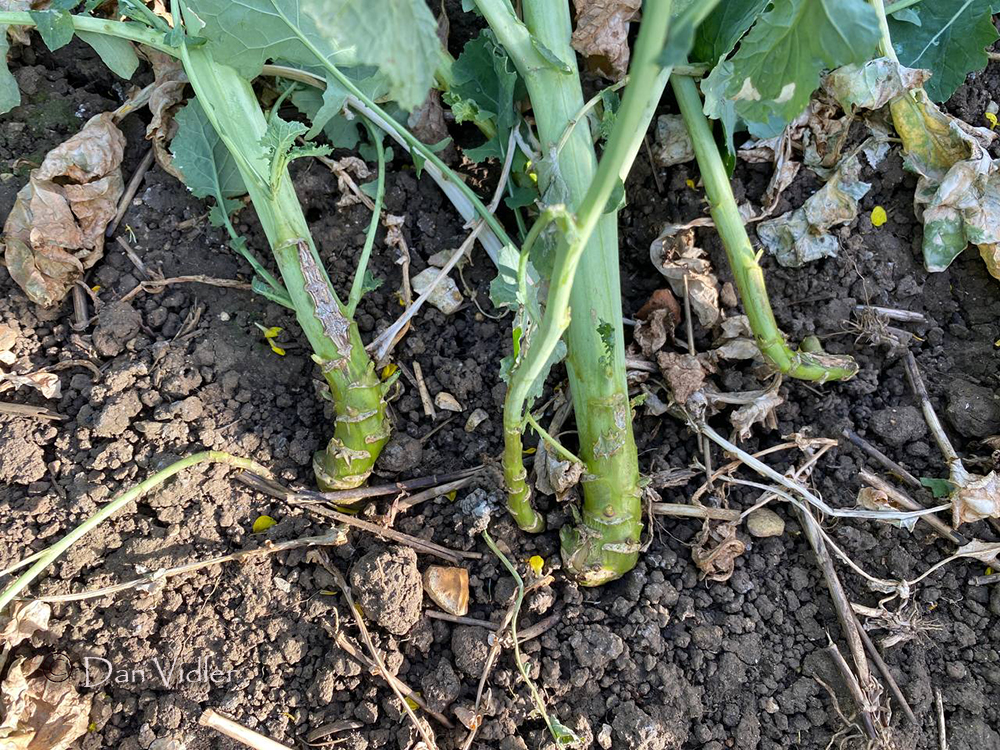
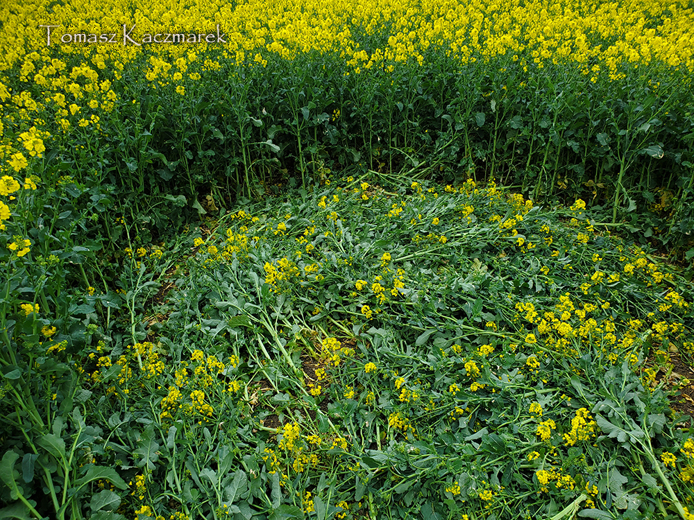
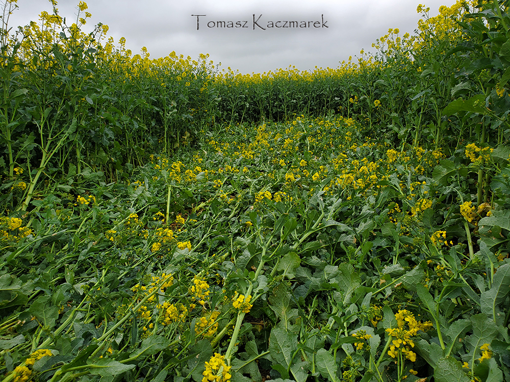
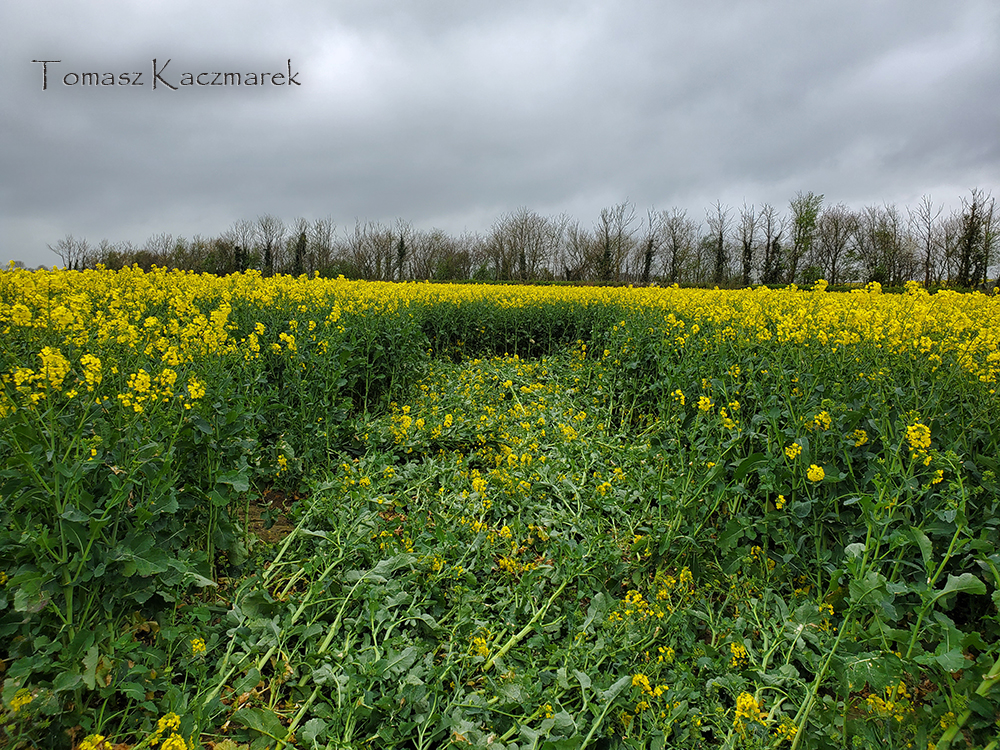
Image Licencing
We can supply high resolution images of many of our photographs and the sky is the limit as to what they can be used for! Choose from our extensive library or contact us to commission aerial photography for your project.
Geometry Gallery
You can read read more of Peter's excellent work on his Facebook Page Geometry of the Crop Circles.
Date
04.04.2026
Crop
Oilseed Rpae (Canola)
Visiting
Google Maps Link. O.S. Grid Ref: ST 52003 24129. What-three-words: pulses.headstone.lingering
You will need permission to visit this field from the farmer.
Further Reading
Find out more on the websites below: